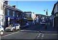
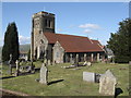
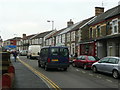
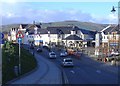
Area Overview for Caerphilly Community
Photos of Caerphilly Community
Area Information
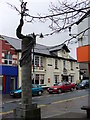
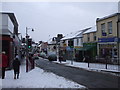
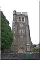
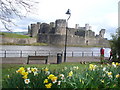
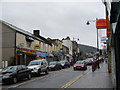
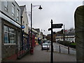
Caerphilly Community is a small civil parish situated on the southern edge of the South Wales coalfield, approximately seven miles north of Cardiff. This area spans 9.7 square kilometres and holds a population of 1,407 residents. The location places you close to Caerphilly Castle, a 13th-century medieval fortification built by Gilbert de Clare that stands as the second largest castle in Britain. The parish lies adjacent to a former Roman fort site, which adds to the locality's historical depth. Evidence of Roman settlement dates back to circa 75-78 AD, while a 6th-century monastery established by Saint Cenydd may have influenced the name Caerffili. Life here reflects a quiet, settled rhythm typical of a community that grew significantly during the 19th-century coal mining boom. You live in an area defined by its proximity to historic landmarks rather than dense urban sprawl. The postcode CF8 1BP identifies this specific neighbourhood within Caerphilly County Borough. Shopping and services rely on the nearby town of Caerphilly, which served as a market centre in medieval times before declining after the 14th century. The area remains distinct from the larger borough, offering a more contained environment for those seeking a smaller-scale settlement. Your daily travel likely involves commuting toward Cardiff or navigating the historic network surrounding the castle. The blend of ancient history and industrial heritage creates a setting that feels rooted in place, yet connected to the broader region of Wales.
- Area Type
- Parish
- Area Size
- 9.7 km²
- Population
- 1407
- Population Density
- 145 people/km²
Demographics
The community composition in Caerphilly Community reveals a settled population with a median age of 70 years. This high figure indicates that the area attracts or retains older adults more than the national average. Households in this parish demonstrate a strong preference for ownership, with 73 percent of residents living in their own homes. This statistic suggests stability and long-term roots rather than a transient student or young professional population. The remaining quarter of residents live in social, tenured, or private rented sectors, though specific breakdowns of these sub-categories are not detailed in current records. You can expect a neighbourhood where established families and retirees form the backbone of social life. The specific age profile of 70 years means local services and social activities often cater to older demographics. While the most common age range data is categorised only as total, the median age confirms the absence of a young workforce driving the local economy. Instead, the economy supports residents through proximity to Cardiff and the tourism draw of Caerphilly Castle. Neither the predominant ethnic group nor religious statistics are explicitly defined in the available data, but the low population density of 145 people per square kilometre suggests a tight-knit social structure. The area feels like a place where long-term residents know one another, reinforcing the dominance of owner-occupied homes across the 9.7 square kilometres of land.
Household Size
Accommodation Type
Tenure
Ethnic Group
Religion
Household Composition
Age
Household Deprivation
NS-SEC
Explore more demographic insights in this area
Go to Demographics tabPlanning
Planning Constraints
- Flood RiskPremium
- Ramsar Wetland SitesPremium
- Area of Outstanding Natural BeautyPremium
- Protected Nature ReservePremium
- Protected WoodlandPremium
- Crime RiskPremium