Area Overview for Blackwood Community
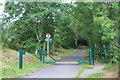
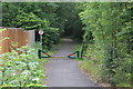
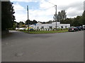
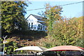
Photos of Blackwood Community


Area Information
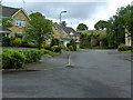
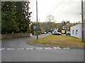
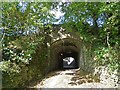
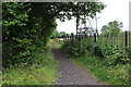
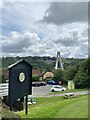
Blackwood Community stands as a historic civil parish within Caerphilly County Borough, covering an area of 4.2 km². Originally founded in the early 19th century around 1820 by colliery owner John Hodder Moggridge as a model village, the location sits by the Sirhowy River in the South Wales Valleys. Despite its mining origins, the modern economy relies on light industrial and high-tech firms rather than traditional coal extraction. You will find yourself in a town defined by significant historical milestones, including its role as a centre for Chartist organisation where Zephaniah Williams gathered insurgents for the 1839 Newport Rising. Local landmarks include the Blackwood Miners' Institute, which opened as a snooker hall in 1925, and Penllwyn House, a former Lord Tredegar property now operating as a public house. Modern life remains connected to the past through transport links like Stagecoach South Wales services covering the Sirhowy valleys and Newport. Living in Blackwood Community offers a setting where 19th-century architectural heritage meets contemporary residential needs within a compact, well-defined boundary.
- Area Type
- Parish
- Area Size
- 4.2 km²
- Population
- Not available
- Population Density
- Not available
Demographics
The resident population of Blackwood Community skews significantly towards older age groups, with a median age of 70 years. This demographic profile indicates that the area is primarily inhabited by retirees or long-term settled families rather than young professionals starting their careers. Approximately three-quarters of households, representing 74% home ownership, hold deeds to their residences. This high level of ownership suggests a stable, established community where residents have deep roots in the local area. While specific figures for household composition and ethnic diversity are not detailed in the current records, the high ownership rate typically points toward a settled society where people remain in their homes for extended periods. You can expect a slower pace of life compared to major cities, with daily rhythms often dictated by local amenities and seasonal changes rather than professional commutes. The age structure means community facilities and local services are likely tailored to the needs of an older demographic.
Household Size
Accommodation Type
Tenure
Ethnic Group
Religion
Household Composition
Age
Household Deprivation
NS-SEC
Explore more demographic insights in this area
Go to Demographics tabPlanning
Planning Constraints
- Flood RiskPremium
- Ramsar Wetland SitesPremium
- Area of Outstanding Natural BeautyPremium
- Protected Nature ReservePremium
- Protected WoodlandPremium
- Crime RiskPremium