Area Overview for Abercarn Community
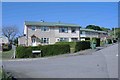
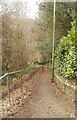
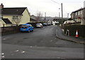
Photos of Abercarn Community


Area Information
Living in Abercarn Community offers a distinct experience within Caerphilly county borough, situated at coordinates 51.649°N 3.135°W. This civil parish stretches across 16.5 km² of the Ebbw Valley, making it a relatively compact area for residents to navigate. The location sits approximately 10 miles northwest of Newport, providing a direct sense of its regional position on the A467 road between Cwmcarn and Newbridge. Historical depth defines the daily rhythm of the town, where the legacy of Richard Crawshay and industrialist Benjamin Hall still colour the landscape. Formerly part of the ancient Monmouthshire parish of Mynyddislwyn, Abercarn officially formed its urban district in 1894 before becoming part of Caerphilly in 1996. You will find Grade II* listed St Luke's Church, a strikingly original building designed by John Coates Carter, which stands as a testament to the architectural confidence of the interwar period. The area also contains the Abercarn Mortuary Chapel, recorded as a historical item within the cemetery. While the town has deep roots in coal mining and ironworks, the human story continues through notable figures like Sir Clement Price Thomas, the surgeon born here who operated on King George VI. Modern life here balances this industrial heritage with contemporary needs, supported by excellent digital infrastructure and minimal flood risk. For those seeking a balance of history and practicality, Abercarn Community presents a settled environment where the past informs the present.
- Area Type
- Parish
- Area Size
- 16.5 km²
- Population
- Not available
- Population Density
- Not available
Demographics
The community profile of Abercarn reveals an older population structure. The median age stands at 70 years, indicating a neighbourhood where long-term residents dominate the demographic landscape. This age distribution suggests a quieter pace of life compared to younger urban centres. Home ownership rates are significantly high, with 69 per cent of households owning their property outright or with a mortgage. This level of equity supports a stable community where families have deep roots rather than transient tenants moving in and out frequently. The household composition data categorises the total number without specifying breakdowns by family size or lone-parent status, which limits detailed analysis of living arrangements. Accommodation types are similarly aggregated under a total category, preventing a granular view of housing varieties beyond general classification. Ethnically, only the total predominant group is recorded, offering no insight into the diversity of the populace. Religious affiliations are also listed only as a total, meaning you cannot determine the specific mix of denominations present. Despite these limitations, the high home ownership rate of 69 per cent points to a financially settled demographic. Residents likely value stability and are invested in the long-term future of Abercarn. This profile is typical of areas with strong industrial histories where older generations have remained throughout the decades. The lack of specific data on deprivation or detailed household types means you must infer community dynamics from the clear dominance of older, owner-occupied households.
Household Size
Accommodation Type
Tenure
Ethnic Group
Religion
Household Composition
Age
Household Deprivation
NS-SEC
Explore more demographic insights in this area
Go to Demographics tabPlanning
Planning Constraints
- Flood RiskPremium
- Ramsar Wetland SitesPremium
- Area of Outstanding Natural BeautyPremium
- Protected Nature ReservePremium
- Protected WoodlandPremium
- Crime RiskPremium