Area Overview for Porthcawl Community
Photos of Porthcawl Community
Area Information
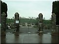
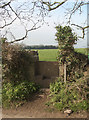
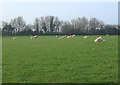
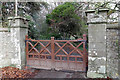
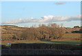
Porthcawl Community is a civil parish located within Bridgend County Borough on the South Wales coast. This coastal resort sits on a low limestone headland overlooking the Bristol Channel, distinct from the larger town which has a broader population figure. The specific community area covers an extended surface of 15.3 km² and serves 9,838 residents. You will find a distinct residential character here, shaped by its history as a former coal port and later a Victorian seaside resort. The location coordinates places it precisely at 51.478941030008436, -3.7059357285241403 under the CF36 postcode. Daily life revolves around proximity to the historic harbour and the Porthcawl Museum, which operates within the former Old Police Station. The residential landscape extends from the waterside to inland neighbourhoods. Rest Bay offers surfing opportunities associated with the Welsh Coast Surf Club, established in 1969. Meanwhile, the Royal Porthcawl Golf Course, founded in 1895 and granted royal status in 1909, anchors the recreational infrastructure. This specific parish represents a mature living environment with deep roots to the industrial past of the Duffryn Llynfi and Porthcawl Railway, which opened around 1828-1829. Whether you are drawn to the breezier coast or the quieter surrounding flats, the area offers a defined identity separate from the wider municipal boundaries while maintaining accessible amenities.
- Area Type
- Parish
- Area Size
- 15.3 km²
- Population
- 9838
- Population Density
- 645 people/km²
Demographics
People living in Porthcawl Community form an established demographic profile defined by a median age of 70. This indicates an area populated predominantly by older residents. The age distribution falls under the inclusive category of Age Total, reflecting a broad cross-section of the established population rather than a youthful cohort. You will encounter 79% home ownership, demonstrating that the majority of residents own their properties outright. This high rate of ownership suggests long-term settlement and stability within these housing stocks. Household composition data is recorded as Total, meaning family structures vary widely throughout the parish. The population density stands at 645 people per square kilometre across the 15.3 km² area. This figure places moderate pressure on local infrastructure while maintaining open residential spaces. Accommodation types are summarised as Total, implying a mix of properties suitable for various needs. While specific ethnicity and religious breakdowns are not detailed in the available records, the community reflects the broader diversity of the region. The high home ownership percentage contrasts with the high median age, pointing to a settled population that has remained in the area for decades. This demographic mix creates a quiet, familial atmosphere where neighbours often know each other well.
Household Size
Accommodation Type
Tenure
Ethnic Group
Religion
Household Composition
Age
Household Deprivation
NS-SEC
Explore more demographic insights in this area
Go to Demographics tabPlanning
Planning Constraints
- Flood RiskPremium
- Ramsar Wetland SitesPremium
- Area of Outstanding Natural BeautyPremium
- Protected Nature ReservePremium
- Protected WoodlandPremium
- Crime RiskPremium