Area Overview for Pencoed Community
Photos of Pencoed Community
Area Information
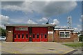
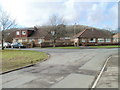
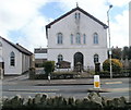
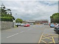
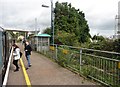
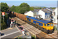
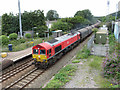
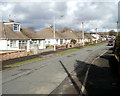
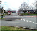
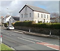
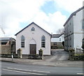
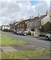
Pencoed Community is a civil parish situated in the county borough of Bridgend, Wales. The area covers 8.8 square kilometres and holds a population of 2,235 residents. This figure differs from the broader town council area, which recorded a population of 10,011 in 2022, indicating the parish boundary is smaller than the wider administrative zone. The name derives from the Welsh words *pen* and *coed*, meaning "head of the wood", reflecting the area's agricultural origins before it became a residential hub. Today, the location functions as a heavily urbanised community near the Ewenny River and the M4 motorway. You can find homes in Pencoed Community that serve as a residential base for workers in the South Wales industrial region. The area transitioned from being sparsely populated woodlands to a commuter settlement in the late nineteenth century. Historical records show Isambard Kingdom Brunel's South Wales Railway station opened in 1856, linking the local hamlets of Pencoed and Penprysg into a unified centre. You benefit from proximity to Bridgend's attractions and the South Wales coast while living within a modern, planned environment. The community includes notable historical sites such as Salem Chapel, which opened in 1775, and Tregroes House, dating back to the early eighteenth century. Living in Pencoed Community offers a blend of historical significance and modern residential practicality. The area grounds its character in its industrial past while functioning as a contemporary locality. You are positioned on a route that served mining and steel industries, providing a stable architectural framework. The community density average is approximately 254 people per square kilometre, creating a settled residential atmosphere.
- Area Type
- Parish
- Area Size
- 8.8 km²
- Population
- 2235
- Population Density
- 254 people/km²
Demographics
The demographic profile of Pencoed Community reveals a residential area dominated by long-term residents. The median age for the population is 70, placing the area significantly older than the national average. This age profile suggests a community where many households consist of retirees or older couples rather than young families or students. You will find that 77% of the population owns their home outright or has a mortgage, indicating strong settlement patterns and financial stability within the parish. Household composition data lists the total category without specifying the breakdown of single-person versus multi-generational living, yet the high age median strongly implies older households. Accommodation type is recorded as a total figure, reflecting the mature nature of the housing stock available to you. There is no specific data provided on ethnic diversity or religious affiliation within the current dataset, though the area acted as a dormitory town for coal and steel workers historically. The population density of 254 people per square kilometre shows that the 2,235 residents are distributed across the 8.8 square kilometre area. These figures indicate a mature community where the primary demographic focus is on established residents. The age profile of a 70-year median suggests you are less likely to encounter a transient population. Instead, the area attracts individuals seeking stability and lower property costs. The high homeownership rate confirms that most residents have secured their homes, contributing to a stable local atmosphere. When considering schools near Pencoed Community, you should note the presence of the Pencoed Agricultural College site, which incorporates historic foundations like Tregroes House, though specific school admission data is not included in the provided records.
Household Size
Accommodation Type
Tenure
Ethnic Group
Religion
Household Composition
Age
Household Deprivation
NS-SEC
Explore more demographic insights in this area
Go to Demographics tabPlanning
Planning Constraints
- Flood RiskPremium
- Ramsar Wetland SitesPremium
- Area of Outstanding Natural BeautyPremium
- Protected Nature ReservePremium
- Protected WoodlandPremium
- Crime RiskPremium