Area Overview for Garw Valley Community
Photos of Garw Valley Community

Area Information
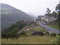
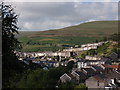
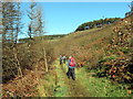
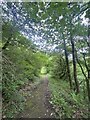
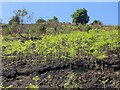
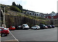
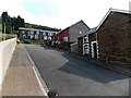
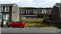
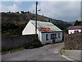
Garw Valley Community serves as a civil parish in the northern part of Bridgend County Borough, South Wales. This area encompasses the valley of the River Garw, spanning 30.9 km² and accommodating a population of 1,161 residents. You will find villages such as Blaengarw at the head of the valley, Pontycymer and Llangeinor alongside the river, and Bettws where the Garw and Llynfi valleys meet in the south. The location sits within the historic centre of the South Wales coalfield, positioned eight miles north of Bridgend. Historically, the region remained untouched by industry until the mid-19th century when coal developments sparked rapid transformation. Early open-cast mining occurred at Llangeinor and Garw Fechan, followed by sinkings at Pontycymmer in 1865-1866 which prompted terrace housing construction for immigrant workers. Major steam coal collieries including the International, Ffaldau and Ocean operations developed later in the 19th century. This rich industrial past shaped the community's identity, leading to the formation of the Garw Miners' Association in 1880 and deep involvement in the South Wales Miners Federation from 1898. Living here means inhabiting a landscape defined by this layered history, where the physical environment reflects a significant period of working-class industrial activity. The area retains its distinct character as a coterminous electoral ward, offering a connection to the region's formidable heritage while functioning as a functional parish today.
- Area Type
- Parish
- Area Size
- 30.9 km²
- Population
- 1161
- Population Density
- 38 people/km²
Demographics
The community demography of Garw Valley Community reflects a mature population profile. The median age for residents stands at 70 years, indicating that most households consist of older adults. You should expect a demographic dominated by this specific age bracket, which influences local service demand and community dynamics. House ownership remains the norm, with 64% of residents owning their homes outright or with a mortgage. This figure suggests a stable, settled population rather than a transient rental market. Household composition data indicates the total makeup of families within the parish, though specific breakdowns by family size are available only as aggregated totals. Accommodation type statistics are recorded for the total population, providing a baseline for the physical housing stock. While specific statistics on predominant ethnic groups and religious affiliation are recorded as total categories, the primary demographic driver is clearly age. The high proportion of home owners in such a rural parish often correlates with retirement migration or long-term settlement. When evaluating what it means for quality of life, a median age of 70 typically suggests a quieter environment with established community networks. However, it also implies a need for health services and accessibility considerations that define the daily experience for those moving into homes in Garw Valley Community.
Household Size
Accommodation Type
Tenure
Ethnic Group
Religion
Household Composition
Age
Household Deprivation
NS-SEC
Explore more demographic insights in this area
Go to Demographics tabPlanning
Planning Constraints
- Flood RiskPremium
- Ramsar Wetland SitesPremium
- Area of Outstanding Natural BeautyPremium
- Protected Nature ReservePremium
- Protected WoodlandPremium
- Crime RiskPremium