Area Overview for Cornelly Community
Photos of Cornelly Community
Area Information
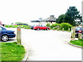
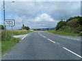
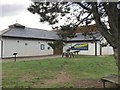
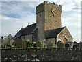
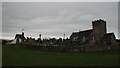
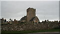
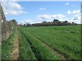
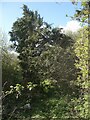
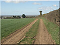
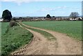
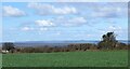
Living in Cornelly Community offers a distinct experience within Bridgend County Borough, South Wales. This civil parish spans 18.3 km² and encompasses the villages of North Cornelly and South Cornelly. The area sits strategically near Pyle and Porthcawl, bisected by major routes including the A48 road and the M4 motorway. Junction 37 of the M4 is located nearby, providing significant access to regional transport networks. The modern administrative boundaries were established by The Bridgend (Cynffig, Cornelly and Pyle Communities) (Electoral Changes) Order 2002. This order divided the former Cynffig area along the mainline railway line during community council elections in May 2004. Today, the ward population recorded as 7,059 in 2011, though the specific parish population stands at 1,393. Residents live in a setting influenced by its historic roots, tracing back to an Anglo-Norman settlement in South Cornelly founded in the second half of the 12th century. Nearby Kenfig, a walled town established in the 1120s, now lies concealed beneath sand dunes. Sker House overlooks these dunes, standing as a historic link to the Knights of St John. The location balances proximity to major infrastructure with the quiet atmosphere of a settled community on the edge of the urban fringe.
- Area Type
- Parish
- Area Size
- 18.3 km²
- Population
- 1393
- Population Density
- 76 people/km²
Demographics
The demographic profile of Cornelly Community reveals a mature population with a median age of 70. This age figure indicates a community dominated by older residents rather than young families or students. The most common age range recorded in the data is simply listed as Age: Total, meaning no specific younger brackets dominate the statistics. Home ownership is high within the parish, with 76% of households owning their properties. This level of equity suggests a stable, long-term resident base deeply rooted in the local area. Household composition data is recorded under a total category, lacking a breakdown of single-person homes versus large families. Accommodation type details are similarly summarised under a total figure rather than a split between detached, semi-detached, or terraced properties. While specific ethnic group and religious affiliation data are listed as totals, the provided figures do not give a granular view of cultural diversity. The area presents as a quiet retirement or settled neighbourhood where property equity is high but the population is not young. Buyers should expect a demographic environment that caters to the needs of older adults rather than those seeking vibrant youth hubs or large school populations.
Household Size
Accommodation Type
Tenure
Ethnic Group
Religion
Household Composition
Age
Household Deprivation
NS-SEC
Explore more demographic insights in this area
Go to Demographics tabPlanning
Planning Constraints
- Flood RiskPremium
- Ramsar Wetland SitesPremium
- Area of Outstanding Natural BeautyPremium
- Protected Nature ReservePremium
- Protected WoodlandPremium
- Crime RiskPremium