Area Overview for Maesteg Community
Photos of Maesteg Community

Area Information
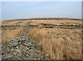
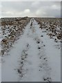
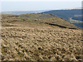
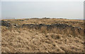
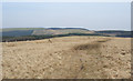
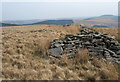
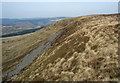
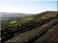
Living in Maesteg Community offers a distinct residential experience within the Llynfi Valley of South Wales. This civil parish covers an area of 27.2 km² and currently is home to 7,113 people. The name Maesteg translates from Welsh as "fair field", reflecting the landscape that existed before the heavy industrial development of the 19th century. The town sits in a valley surrounded by high mountains, creating a defined and enclosed environment for its residents. While the area served as a major industrial hub for iron production and coal mining, it has since transitioned into a primarily residential community. It now functions as a dormitory town serving the larger employment centres of Port Talbot, Bridgend, and Cardiff. The historic Town Hall, opened in October 1881, remains a central feature of the local area. Today, Maesteg is a settled neighbourhood where daily life revolves around these historic landmarks and its quiet valley setting. The community balances its industrial heritage with modern residential needs, offering homes away from the primary commercial hubs while maintaining direct links to them via road networks.
- Area Type
- Parish
- Area Size
- 27.2 km²
- Population
- 7113
- Population Density
- 261 people/km²
Demographics
The demographic profile of Maesteg Community reveals an older population where 66% of residents own their homes. The median age in the parish is recorded at 70 years, indicating a significant proportion of the population consists of older adults. This age distribution suggests a community with a strong presence of retirees and those seeking stability. With a population of 7,113 spread across 27.2 km², the area has a density of 261 people per square kilometre. This level of density supports a neighbourhood feel without the congestion of larger urban centres like Cardiff. The high percentage of home ownership points towards established families and long-term residents who have put down roots in the valley. Household composition in the area reflects this stability, with fewer transient populations compared to younger, rental-heavy districts. The ethnic and religious data for the total population are recorded as aggregates, confirming a cohesive community structure. For families considering Maesteg, the age profile suggests safety and tranquillity, though it may not suit those seeking the energy of a young, mixed-age city centre.
Household Size
Accommodation Type
Tenure
Ethnic Group
Religion
Household Composition
Age
Household Deprivation
NS-SEC
Explore more demographic insights in this area
Go to Demographics tabPlanning
Planning Constraints
- Flood RiskPremium
- Ramsar Wetland SitesPremium
- Area of Outstanding Natural BeautyPremium
- Protected Nature ReservePremium
- Protected WoodlandPremium
- Crime RiskPremium