Area Overview for NP23 5EY
Photos of NP23 5EY

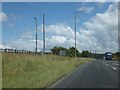
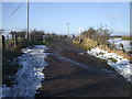
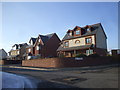
24 photos from this area
Area Information
Key information about the NP23 5EY including its size, population, and administrative classification.
- Area Type
- Postcode
- Area Size
- 55.9 hectares
- Population
- 1175
- Population Density
- 765 people/km²
House Prices in NP23 5EY
25
Properties
£250,193
Average Sold Price
£2,200
Lowest Price
£1,600,000
Highest Price
Showing 25 properties
| Address | Type | Beds | Baths | Last Sale Price | Last Sale Date | |
|---|---|---|---|---|---|---|
| Bryntirion, 0 Llangynidr Road, Beaufort, Ebbw Vale, NP23 5EY | Semi-detached | 3 | 1 | £260,000 | Mar 2024 | |
| Lynwood, Llangynidr Road, Beaufort, Ebbw Vale, NP23 5EY | Bungalow | 3 | 1 | £182,500 | Oct 2023 | |
| Tyn Y Ryn, Llangynidr Road, Beaufort, Ebbw Vale, NP23 5EY | house | - | - | £180,000 | Jun 2022 | |
| Ty Mynydd, Llangynidr Road, Beaufort, Ebbw Vale, NP23 5EY | Detached | 5 | 2 | £285,000 | Apr 2021 | |
| Oakbury House, Llangynidr Road, Beaufort, Ebbw Vale, NP23 5EY | house | - | - | £345,000 | Jan 2021 | |
| Hawthorn Corner, Llangynidr Road, Beaufort, Ebbw Vale, NP23 5EY | Detached | 4 | 2 | £2,200 | Dec 2020 | |
| Bank House, Llangynidr Road, Beaufort, Ebbw Vale, NP23 5EY | hospital_care_home | - | - | £1,600,000 | Jul 2016 | |
| Garwen, Llangynidr Road, Beaufort, Ebbw Vale, NP23 5EY | Bungalow | - | - | £76,000 | May 2016 | |
| Moorland View Bungalow, Llangynidr Road, Beaufort, Ebbw Vale, NP23 5EY | Bungalow | 3 | - | £155,000 | Apr 2016 | |
| Garnlydan Cottage, Llangynidr Road, Beaufort, Ebbw Vale, NP23 5EY | Detached | - | - | £39,000 | Mar 2016 |
Page 1 of 3
Energy Efficiency in NP23 5EY
Amenities
Schools
| Rank | School | Type | Entry gender | Ages |
|---|
Explore more schools in this area
Go to Schools tabDemographics
Household Size
Two person
most common
Accommodation Type
Houses
most common
Tenure
43
majority
Ethnic Group
White
most common
Religion
N/A
most common
Household Composition
N/A
most common
Age
47
median
Adults (30-64 years)
most common
Household Deprivation
N/A
with no deprivation
NS-SEC
11
in Lower managerial occupations
Explore more demographic insights in this area
Go to Demographics tabPlanning
Planning Constraints
- Flood RiskPremium
- Ramsar Wetland SitesPremium
- Area of Outstanding Natural BeautyPremium
- Protected Nature ReservePremium
- Protected WoodlandPremium
- Crime RiskPremium