Area Overview for NP13 2RB
Photos of NP13 2RB
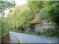
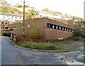
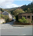
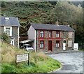
28 photos from this area
Area Information
Key information about the NP13 2RB including its size, population, and administrative classification.
- Area Type
- Postcode
- Area Size
- 6.8 hectares
- Population
- 1442
- Population Density
- 1810 people/km²
House Prices in NP13 2RB
60
Properties
£72,413
Average Sold Price
£28,000
Lowest Price
£120,000
Highest Price
Showing 60 properties
| Address | Type | Beds | Baths | Last Sale Price | Last Sale Date | |
|---|---|---|---|---|---|---|
| 12 High Street, Llanhilleth, Abertillery, NP13 2RB | Terraced | 5 | 2 | £90,000 | Dec 2024 | |
| 11 High Street, Llanhilleth, Abertillery, NP13 2RB | Terraced | 4 | 1 | £105,000 | Jul 2024 | |
| 10 High Street, Llanhilleth, Abertillery, NP13 2RB | Flat | - | - | £100,000 | Aug 2023 | |
| 16 High Street, Llanhilleth, Abertillery, NP13 2RB | Terraced | 3 | 2 | £90,000 | Nov 2020 | |
| 17 High Street, Llanhilleth, Abertillery, NP13 2RB | Terraced | 1 | 1 | £52,000 | Apr 2020 | |
| 14 High Street, Llanhilleth, Abertillery, NP13 2RB | Terraced | 3 | 1 | £95,000 | Dec 2018 | |
| Old Post Office, High Street, Llanhilleth, Abertillery, NP13 2RB | Maisonette | 4 | - | £45,000 | Aug 2018 | |
| Hong Kong Chinese Takeaway, 5 High Street, Llanhilleth, Abertillery, NP13 2RB | Terraced | 3 | 1 | £55,000 | Feb 2018 | |
| 8 High Street, Llanhilleth, Abertillery, NP13 2RB | Terraced | 3 | 2 | £62,000 | Sep 2016 | |
| 7 High Street, Llanhilleth, Abertillery, NP13 2RB | Terraced | 4 | 1 | £49,950 | Feb 2016 |
Page 1 of 6
Energy Efficiency in NP13 2RB
Amenities
Schools
| Rank | School | Type | Entry gender | Ages |
|---|
Explore more schools in this area
Go to Schools tabDemographics
Household Size
One person
most common
Accommodation Type
Houses
most common
Tenure
61
majority
Ethnic Group
White
most common
Religion
N/A
most common
Household Composition
N/A
most common
Age
47
median
Adults (30-64 years)
most common
Household Deprivation
N/A
with no deprivation
NS-SEC
17
in Lower managerial occupations
Explore more demographic insights in this area
Go to Demographics tabPlanning
Planning Constraints
- Flood RiskPremium
- Ramsar Wetland SitesPremium
- Area of Outstanding Natural BeautyPremium
- Protected Nature ReservePremium
- Protected WoodlandPremium
- Crime RiskPremium