Area Overview for Abertillery Community
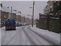
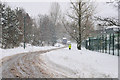
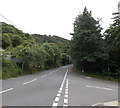
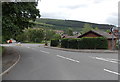
Photos of Abertillery Community
Area Information
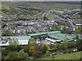
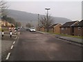
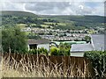
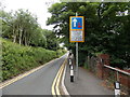
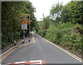
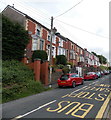
Living in Abertillery Community places you within a civil parish in Blaenau Gwent, Wales, defined by a distinct historical legacy rooted in the Ebbw Valley. This area encompasses approximately 18.8 square kilometres and currently accommodates a population of 3,058 residents. Historically, the parish was a rural settlement of farms in the ancient parish of Aberystruth, described in 1779, before accelerating into an industrial hub dominated by coal mining which began in 1843. The mining sector drove rapid expansion in the late 19th and early 20th centuries, reaching nearly 40,000 inhabitants by 1931, a demographic shock that shaped the modern physical landscape. Today, the community includes specific locales such as Cwmtillery, Brynithel, and Aberbeeg, each carrying their own associations with the town's industrial past. You will find tangible reminders of this era in the form of Victorian architecture, such as the Abertillery Arcade from the late 1890s and the former Bon Marché department store. Current residents enjoy a new digital history trail unveiled in 2025, which highlights sites like the town library and the Limes House. The area offers a mix of heritage and modern life, though your daily routine will revolve around valley geography and the limited remaining commercial infrastructure. Understanding this context is essential for anyone considering finding homes in Abertillery Community, as the environment reflects a transition from heavy industry to a quieter, yet historically dense, residential setting.
- Area Type
- Parish
- Area Size
- 18.8 km²
- Population
- 3058
- Population Density
- 163 people/km²
Demographics
The demographic profile of Abertillery Community is characterised by a significantly older population compared to the rest of the United Kingdom. The median age here stands at 70 years, indicating that the community skews heavily towards older adults. While the 'Total' age range represents the entire demographic spread, the high median age is the defining statistical characteristic of the parish. With a population of 3,058 housed across 18.8 square kilometres, the density reaches 163 people per square kilometre. Housing patterns reflect this age demographic, with 65 per cent of residents owning their homes outright or with a mortgage. This indicates a very high level of home ownership, suggesting stability rather than a transient rental population. The accommodation composition confirms this static nature, though specific breakdowns of living arrangements within this age group are not detailed in available records. You should expect a community where long-term residents are likely to have lived there for decades. The area does not show data for predominant ethnic groups, religious affiliation, or specific household vessel types beyond the overall composition category. This lack of granular diversity data means the picture is statistically simple, dominated by age and ownership status. If you are looking for a community defined by these metrics, Abertillery Community fits a profile of an established, older, and largely home-owning population without the volatility often found in younger urban centres.
Household Size
Accommodation Type
Tenure
Ethnic Group
Religion
Household Composition
Age
Household Deprivation
NS-SEC
Explore more demographic insights in this area
Go to Demographics tabPlanning
Planning Constraints
- Flood RiskPremium
- Ramsar Wetland SitesPremium
- Area of Outstanding Natural BeautyPremium
- Protected Nature ReservePremium
- Protected WoodlandPremium
- Crime RiskPremium