Area Overview for Newtown St Boswells
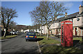
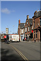
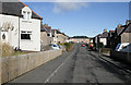
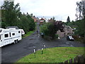
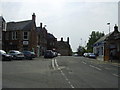
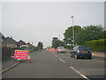
Photos of Newtown St Boswells


Area Information
Newtown St Boswells is a built-up area in Scotland, covering 54.2 hectares. It lies within the Scottish Borders, a region known for its rural landscapes and historic towns. The area is compact, making it practical for residents seeking a balance between local amenities and nearby natural surroundings. Daily life here is shaped by its proximity to transport links and retail options, with a mix of small-town convenience and the quietude of a less densely populated region. The area’s character is defined by its accessibility to rail and bus services, which connect it to larger centres like Galashiels and Tweedbank. While the population figures are not provided, the area’s size suggests a community that is neither sprawling nor overly congested. For those considering living in Newtown St Boswells, the focus is on practical living, with homes and services designed for ease of access rather than urban vibrancy. The area is ideal for those prioritising connectivity to transport networks and nearby retail, without the pressures of a larger city.
- Area Type
- Built Up Area 250
- Area Size
- 54.2 hectares
- Population
- Not available
- Population Density
- Not available
Living in Newtown St Boswells offers access to a range of local amenities within walking or short driving distance. Retail options include Co-op Newtown, Morrisons Daily Melrose St, and Spar Mmis, providing essentials for daily living. The area’s rail links to Tweedbank and Galashiels connect residents to broader shopping, dining, and leisure opportunities in nearby towns. While specific parks or recreational spaces are not detailed in the data, the proximity to transport hubs suggests easy access to outdoor activities in the surrounding Scottish Borders countryside. The presence of multiple retail outlets and transport points contributes to a convenient, self-contained lifestyle, though the area’s character leans more towards practicality than extensive leisure facilities. For those prioritising proximity to shops, transport, and regional connectivity, Newtown St Boswells delivers a straightforward, functional living experience.
Amenities
Schools
| Rank | School | Type | Entry gender | Ages |
|---|
Explore more schools in this area
Go to Schools tabDemographics
Household Size
Accommodation Type
Tenure
Ethnic Group
Religion
Household Composition
Age
Household Deprivation
NS-SEC
Explore more demographic insights in this area
Go to Demographics tabPlanning
Planning Constraints
- Crime RiskPremium