Area Overview for Roxburgh, Ettrick and Lauderdale
Photos of Roxburgh, Ettrick and Lauderdale
Area Information
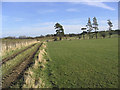
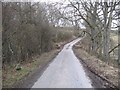
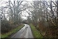
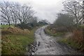
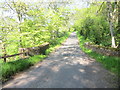
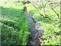
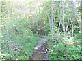
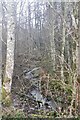
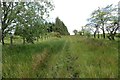
Living in Roxburgh, Ettrick and Lauderdale offers a distinctly rural experience within Scotland's borders. This ceremonial county covers a vast expanse of 2923.4 km², transforming distances that feel significant in urban centres into manageable spans across open countryside. You will find yourself situated in a landscape defined by Ettrick Forest and the banks of the Tweed, an environment where daily life revolves around seasonal change rather than the 9-to-5 commute cycle typical of major cities. The region encompasses the smaller council areas of Roxburghshire and part of the historic Berwickshire territory, creating a unique geographical identity. Residents here are accustomed to long distances to employment hubs in Edinburgh or Berwick-upon-Tweed, a reality that shapes the local economy and social rhythm. The sheer scale means that "local" shops or amenities are spaced several miles apart, encouraging car ownership and outdoor activity. This is not a metropolitan area but a home for those who prioritise space and nature over urban proximity. When you move to Roxburgh, Ettrick and Lauderdale, you accept a life where the horizon stretches far beyond the immediate doorstep.
- Area Type
- Ceremonial Counties Region
- Area Size
- 2923.4 km²
- Population
- Not available
- Population Density
- Not available
Demographics
The community profile in Roxburgh, Ettrick and Lauderdale reflects a population deeply rooted in the land rather than transient urban workers. You will find households skewed towards older age groups, a common trait in rural Scottish straths and shires where retirement and long-term farming persist. Fewer young professionals or students migrate here compared to the Lothians, resulting in a stable but slowly ageing demographic mix. Accommodation types mirror this history, with a high prevalence of older cottages and farmsteads alongside newer builds on the fringes of small villages like Innerleithen or Kelso. Home ownership levels remain strong here, driven by the fact that many families have purchased these properties over generations rather than renting them. Deprivation metrics are generally lower in comparison to dense urban pockets, as widespread poverty is less common in these remote areas. Instead of gritty city deprivation, you encounter the challenges of isolation and limited local services. The diversity of the population leans heavily towards the native Scottish stock, with smaller pockets of recent migration from overseas largely concentrated in the few larger towns. Every claim about living here must account for this quiet, established rhythm where community ties are forged through shared rural inconvenience.
Household Size
Accommodation Type
Tenure
Ethnic Group
Religion
Household Composition
Age
Household Deprivation
NS-SEC
Explore more demographic insights in this area
Go to Demographics tabPlanning
Planning Constraints
- Crime RiskPremium