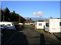
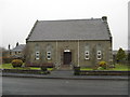
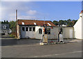
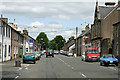
Area Overview for Newcastleton
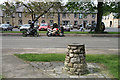
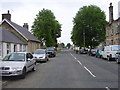
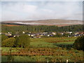
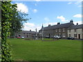
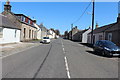
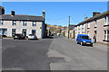
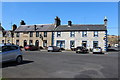
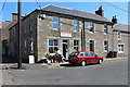
Photos of Newcastleton
Area Information
Newcastleton is a compact built-up area in Scotland, covering 34.3 hectares. Its small size gives it a close-knit feel, with residents likely to know their neighbours. Located in a rural setting, it balances proximity to essential services with a quieter, more secluded lifestyle. The area’s single notable retail outlet, Spar Newcastleton, serves as a practical hub for daily needs. While the broadband score is poor, the mobile coverage is good, ensuring residents can stay connected on the move. Newcastleton appears to cater to those seeking simplicity, with limited commercial infrastructure but a focus on local amenities. Its character is defined by practicality and proximity to nature, though the lack of detailed demographic data means its community profile remains less defined. For buyers, it’s a place where convenience and tranquillity intersect, though the digital connectivity limitations may be a consideration for remote workers.
- Area Type
- Built Up Area 250
- Area Size
- 34.3 hectares
- Population
- Not available
- Population Density
- Not available
Newcastleton’s lifestyle is shaped by its limited but functional amenities. The Spar Newcastleton is the closest retail option, providing essentials like groceries and basic goods. This suggests a focus on practicality over variety, with residents likely relying on nearby towns for more extensive shopping or dining. The absence of named parks, leisure facilities, or cultural venues means outdoor and recreational opportunities are not explicitly detailed in the data. However, the area’s small footprint may encourage walking or cycling for short errands. For those valuing convenience and simplicity, Newcastleton offers a straightforward lifestyle, though its amenities are minimal compared to larger settlements. The character of the area is defined by its practical approach to daily living, with a reliance on nearby services to supplement local offerings.
Amenities
Schools
| Rank | School | Type | Entry gender | Ages |
|---|
Explore more schools in this area
Go to Schools tabDemographics
Household Size
Accommodation Type
Tenure
Ethnic Group
Religion
Household Composition
Age
Household Deprivation
NS-SEC
Explore more demographic insights in this area
Go to Demographics tabPlanning
Planning Constraints
- Crime RiskPremium