Area Overview for PH16 5NS
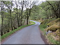
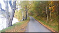
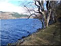
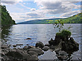
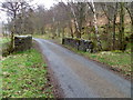
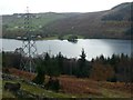
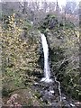
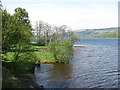
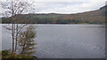
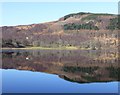
Photos of PH16 5NS
Area Information
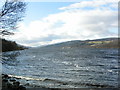
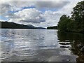
PH16 5NS covers 3.7 km² within Perth and Kinross, a unitary council area that encompassed the historic counties of Kinross-shire and most of Perthshire. This postcode represents a specific residential cluster located in central Scotland. You will find this area bordered by Highland and Aberdeenshire to the north, Angus, Dundee, and Fife to the east, Clackmannanshire to the south, and Stirling and Argyll and Bute to the west. The location sits near the eastern boundary of Perth and Kinross. Living in PH16 5NS means residing within an environment shaped by the region's administrative history, which saw the Perth and Kinross Joint County Council form in 1930 before becoming a district within Tayside in 1975. The area reformed as a unitary council in 1996 under the Local Government etc. (Scotland) Act 1994. Daily life here is defined by its position in a region that includes the Lieutenancy of Perth and Kinross. You are situated in a setting where local governance has evolved over decades from medieval sisterhood administration to modern unitary status.
- Area Type
- Postcode
- Area Size
- 3.7 km²
- Population
- Not available
- Population Density
- Not available
The property market profile for PH16 5NS relies on geographical context rather than specific transaction data. This 3.7 km² area functions as a small residential cluster within the wider Perth and Kinross framework. You will not find statistics on the percentage of owner-occupied versus rental properties in the provided information. Details regarding the predominant home types, such as detached houses, flats, or terraced properties, are not included. The market character of this specific postcode cannot be defined by occupancy rates because that data is absent. Buyers looking at this small area must rely on the known infrastructure of surrounding settlements like Pitlochry and Blair Atholl. The lack of specific market figures means you cannot assess price trends or rental yields for PH16 5NS directly. The area exists within a region that added Longforgan from Dundee through minor boundary adjustments in 1996. While the broader region supports a mix of housing, the specific stock for PH16 5NS remains undefined in the current dataset. You should approach purchasing here with an understanding that detailed market statistics are not readily accessible for this distinct cluster.
House Prices in PH16 5NS
Showing 10 properties
Energy Efficiency in PH16 5NS
Living in PH16 5NS offers access to specific amenities within practical reach of residents. You are close to Blair Atholl Railway Station and Pitlochry Railway Station, providing two rail connections for travel. For shopping needs, Spar and Co-op Pitlochry serve the area, offering three retail points within easy distance. These facilities form the core of daily life for those calling this 3.7 km² postcode home. You do not have data on dining establishments, parks, or leisure centres for this specific cluster. The available information highlights the proximity to transport hubs and essential grocery stores. Convenience centres like Spar ensure basic needs are met without lengthy commutes. While the broader Perth and Kinross region is known for its historic counties and natural beauty, the specific lifestyle data for PH16 5NS focuses on these key assets. You rely on these named venues for your immediate convenience. The presence of these stations and shops defines the accessibility of this residential cluster.
Amenities
Schools
| Rank | School | Type | Entry gender | Ages |
|---|
Explore more schools in this area
Go to Schools tabDemographics
Direct population statistics for PH16 5NS are not included in the provided information. Consequently, you cannot see specific figures for age profiles, household types, or accommodation types for this postcode. The absence of these specific data points prevents a detailed breakdown of the community composition. Similarly, figures for home ownership levels, accommodation type distributions, and diversity metrics are not available for this specific location. You cannot determine the exact mix of owner-occupied and rental properties without this primary data. Detailed deprivation data is likewise absent from the information covering this area. While the broader region of Perth and Kinross contains villages and towns with varied demographics, the specific granularity for PH16 5NS is not provided. Any claim regarding the age of residents or the percentage of families versus singles would be speculation rather than fact. The available data focuses on geographical boundaries and administrative history rather than the social makeup of the specific homes in this cluster.
Household Size
Accommodation Type
Tenure
Ethnic Group
Religion
Household Composition
Age
Household Deprivation
NS-SEC
Explore more demographic insights in this area
Go to Demographics tabPlanning
Planning Constraints
- Flood RiskPremium
- Ramsar Wetland SitesPremium
- Area of Outstanding Natural BeautyPremium
- Protected Nature ReservePremium
- Protected WoodlandPremium
- Crime RiskPremium