Area Overview for PH16 5RJ
Photos of PH16 5RJ
Area Information
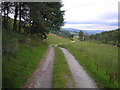
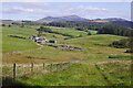
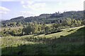
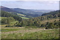
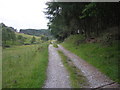
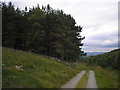
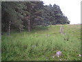
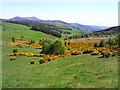
You are entering a specific residential cluster defined by the postcode PH16 5RJ, which covers 9.7 km² in Scotland. This location exists within the broader Perth and Kinross council area, a region formed from the historic counties of Perthshire and Kinross-shire. The unitary council area officially emerged in 1996 following a reorganisation of local government. Living in PH16 5RJ means residing in a defined geographical cluster rather than a sprawling urban centre. The area sits within the ceremonial boundaries of central Scotland, bordered by Highland and Aberdeenshire to the north and Clackmannanshire to the south. While broader research defines the region's administrative history, your daily life in this specific postcode cluster is shaped by its compact size and rural designation. This area represents a small but distinct node within the larger Perth and Kinross network. You will find yourself in a setting that prioritises a defined residential footprint over density. The identity of PH16 5RJ is tied directly to this 9.7 km² boundary, separating it from adjacent labour market areas and distinct council jurisdictions.
- Area Type
- Postcode
- Area Size
- 9.7 km²
- Population
- Not available
- Population Density
- Not available
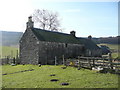
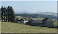
Specific data regarding home ownership rates, accommodation types, or the mix of houses and flats for PH16 5RJ is currently absent from the provided information. You cannot determine whether the 9.7 km² postcode cluster is dominated by detached cottages, multi-unit blocks, or a mixture of property types. The lack of housing stock data prevents an analysis of whether this area functions as a primary residence zone or a commuter satellite. Without figures on tenancy versus ownership, the nature of the property market remains unclear. Similarly, information on average sale prices or rental yields for this specific code is not included. Buyers must recognise that decisions about purchasing homes in PH16 5RJ cannot be informed by statistically averaged trends or comparative market analysis derived from this dataset. The physical description remains the only confirmed attribute of the property stock available to review.
House Prices in PH16 5RJ
Showing 20 properties
Energy Efficiency in PH16 5RJ
Your daily routine in PH16 5RJ revolves around a small set of practical amenities located within practical reach. For rail travel, two stations serve the wider area: Blair Atholl Railway Station and Pitlochry Railway Station. These provide access to the broader rail network beyond the immediate cluster. For retail needs, you can visit a Spar or the Co-op in Pitlochry. These are the specific named retail outlets documented as nearest to your location. Living in PH16 5RJ means you rely on nearby towns for fresh groceries, essential shop runs, and general retail services. The local cluster itself functions as a residential backdrop rather than a commercial hub. You will find no mention of local parks, leisure centres, or specific dining venues in the immediate vicinity of this postcode. Convenience is managed through travel to Pitlochry for stocked shops and seasonal travel station plans.
Amenities
Schools
| Rank | School | Type | Entry gender | Ages |
|---|
Explore more schools in this area
Go to Schools tabDemographics
Detailed information regarding the age profile, household types, and deprivation levels for PH16 5RJ is not provided in the available records for this specific postcode. Without specific census figures, it is impossible to confirm the exact composition of the community or the ratio of owner-occupiers to renters within this 9.7 km² cluster. Broader insights into population diversity or income distribution generally require specific data points for this location. Consequently, any attempt to describe the socioeconomic makeup of residents would be speculative and unsupported by the source material. You cannot verify the character of the neighbourhood without access to granular demographic statistics for this precise code. The available data only confirms the physical dimensions and administrative classification of the area, leaving the human element of the community undefined by hard figures.
Household Size
Accommodation Type
Tenure
Ethnic Group
Religion
Household Composition
Age
Household Deprivation
NS-SEC
Explore more demographic insights in this area
Go to Demographics tabPlanning
Planning Constraints
- Flood RiskPremium
- Ramsar Wetland SitesPremium
- Area of Outstanding Natural BeautyPremium
- Protected Nature ReservePremium
- Protected WoodlandPremium
- Crime RiskPremium