Area Overview for Rosewell
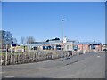
Photos of Rosewell


Area Information
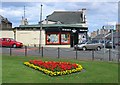
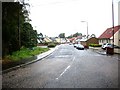
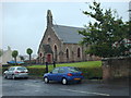
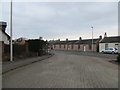
Rosewell is a built-up area in Scotland, spanning 68.4 hectares, offering a compact yet functional living environment. Its location provides access to essential services and transport links, making it a practical choice for those seeking convenience without the sprawl of larger towns. Residents benefit from proximity to retail outlets such as Co-op Scotmid, Morrisons Daily, and Tesco Rosewell, ensuring daily needs are met with ease. The area’s rail connectivity is notable, with five nearby stations including Newtongrange, Eskbank, and Gorebridge, facilitating easy travel to surrounding regions. Digital connectivity is robust, with a broadband score of 96, reflecting excellent fixed-line performance, and mobile coverage rated at 84, sufficient for most needs. These factors make Rosewell appealing to professionals requiring reliable internet for remote work and families prioritising accessibility. The area’s character is defined by its balance of practicality and proximity to amenities, catering to a range of lifestyles. Whether commuting or staying local, Rosewell offers a straightforward, no-frills approach to living in a Scottish town.
- Area Type
- Built Up Area 250
- Area Size
- 68.4 hectares
- Population
- Not available
- Population Density
- Not available
Living in Rosewell offers access to a range of local amenities within practical reach. The retail sector is well-served by five nearby stores, including Co-op Scotmid, Morrisons Daily, and Tesco Rosewell, ensuring everyday shopping needs are met without long journeys. These stores provide a mix of essentials and convenience, supporting a straightforward lifestyle. The rail network adds to the area’s accessibility, with stations like Newtongrange and Eskbank offering connections to broader destinations. While specific details on parks or leisure facilities are not provided, the presence of multiple retail and transport options suggests a focus on practicality over expansive leisure spaces. For residents prioritising convenience over sprawling recreational areas, Rosewell’s amenities align with a no-nonsense approach to daily living. The compact size of the area means most services are within walking or short driving distance, reducing the need for extensive travel.
Amenities
Schools
| Rank | School | Type | Entry gender | Ages |
|---|
Explore more schools in this area
Go to Schools tabDemographics
Household Size
Accommodation Type
Tenure
Ethnic Group
Religion
Household Composition
Age
Household Deprivation
NS-SEC
Explore more demographic insights in this area
Go to Demographics tabPlanning
Planning Constraints
- Crime RiskPremium