Area Overview for Midlothian
Photos of Midlothian
Area Information
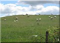
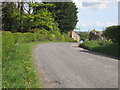
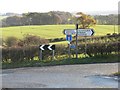
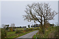
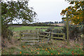
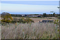
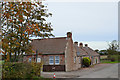
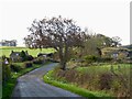
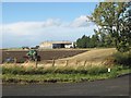
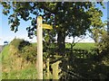
Midlothian operates as a local authority district in southeastern Scotland, covering an expanse of 355.5 square kilometres south of Edinburgh and the Firth of Forth. This region functions as part of one of Scotland's 32 local authorities, acting as a bridge between either high-tech suburbia and rolling countryside. Towns such as Dalkeith, Penicuik, Bonnyrigg, and Loanhead define the residential landscape, offering a mix of established urban communities and rural settlements. The territory stretches from low coastal plains in the north to gently rolling land that slopes upward towards the Moorfoot Hills in the south. The River Esk flows northward through the district, carrying water from the agricultural lowlands. Like many areas transitioning from industrial roots into modern service economies, Midlothian has shifted its focus significantly. The council area now concentrates on services, tourism, and science-based industries, identifying as the fastest growing local authority in Scotland. You will find a population benefitting from proximity to Edinburgh while enjoying open spaces and established towns. Daily life revolves around this blend of resilience and modernisation, with the administrative centre situated in Dalkeith. The geography supports a variety of lifestyles, from those drawn to the younger demographic hubs in the eastern wards to families settling in the more suburban Enclaves of Penicuik. You are entering a district where the historic mining past has given way to a future driven by innovation and regional growth.
- Area Type
- District/Borough
- Area Size
- 355.5 km²
- Population
- Not available
- Population Density
- Not available
Demographics
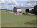
The community profile of Midlothian reflects a distinct shift towards a younger population compared to older parts of the south of Scotland. The working-age population forms the core of the local demographic, establishing the base for the region's rapid economic expansion. Accommodation types vary across the six wards of Bonnyrigg, Dalkeith, Midlothian East, Midlothian South, Midlothian West, and Penicuik, catering to the needs of these working residents. While specific age breakdowns for every ward are not detailed in the available summary, the overall character suggests a community built around professional and service sector employment. The economic engine relies heavily on electronics manufacturing concentrated in the suburban towns outside Edinburgh. This industrial focus drives demand for housing in specific pockets of the council area. Agriculture remains present as a secondary livelihood, with crops including oats, barley, potatoes, turnips, and wheat, alongside dairy cattle and sheep farming. However, the scale of farming does not compete with the residential footprint in the main towns. You will find a mix of traditional residential communities and business development zones. The rapid growth identified by Midlothian Council indicates a steady influx of families and professionals. This demographic trend underscores a region that is evolving into a key regional hub. Family life in Midlothian centres on the established towns where schools and amenities serve a predominantly working-age household population.
Household Size
Accommodation Type
Tenure
Ethnic Group
Religion
Household Composition
Age
Household Deprivation
NS-SEC
Explore more demographic insights in this area
Go to Demographics tabPlanning
Planning Constraints
- Flood RiskPremium
- Ramsar Wetland SitesPremium
- Area of Outstanding Natural BeautyPremium
- Protected Nature ReservePremium
- Protected WoodlandPremium
- Crime RiskPremium