Area Overview for City of Edinburgh
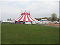
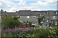
Photos of City of Edinburgh


Area Information
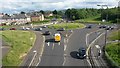
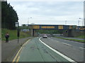
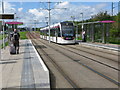
Living in the City of Edinburgh means residing within a local authority district that governs both the historic urban centre and a significant rural Green Belt fringe. You will find the population according to mid-2019 figures was 518,500, making it a substantial region for settlement across 273.1 square kilometres. The area operates under the City of Edinburgh Council, which manages essential public services ranging from housing and waste management to parks and culture. Governance currently traces back to a 1996 reorganisation that established the present council structure, replacing the former City of Edinburgh District Council. This evolution occurred under the Local Government etc. (Scotland) Act 1994, marking a shift from the Lothian region's previous framework. Daily life here involves interaction with a system divided into 17 wards, each electing councillors who represent local interests. The geography offers a distinct contrast between the capital city's dense urban fabric and the quieter outskirts that form part of the Green Belt. You are positioned at coordinates 55.9265233680371, -3.288356646039049, placing you centrally within Scotland's second largest administrative area by budget, which runs approximately £1 billion. The region serves as the unitary council area for the entire city, integrating economic development strategies with community planning. Whether you seek historic architecture or rural surroundings, the City of Edinburgh encompasses these varied landscapes within its defined boundaries.
- Area Type
- District/Borough
- Area Size
- 273.1 km²
- Population
- Not available
- Population Density
- Not available
Demographics
The Community in City of Edinburgh is shaped by its role as the capital's governing district, though specific demographic breakdowns such as age profiles and household types are not detailed in the current records. Without exact figures on housing tenure or family composition, the available research focuses on the administrative scale rather than residential character. The area contains 518,500 residents based on mid-2019 data, indicating a large and established population. While precise statistics on home ownership levels or accommodation types by area are absent from the provided dataset, theouncillors elected from the 17 wards must represent a diverse cross-section of this population. The governance structure itself reflects the community needs through the democratic process of electing 63 councillors. These representatives operate under a budget of around £1 billion, which supports services directly affecting daily life such as social care, education, and housing. The history of the area shows a long tradition of local governance dating back to 1130 when David I established the town as a royal burgh. Community Councils were first formalised following the Local Government (Scotland) Act 1973, providing a layer of local input before the 1996 restructuring. You are part of a longstanding administrative unit where decisions on waste management, economic development, and festivals are made locally. The region balances urban intensity with rural fringes, creating a unique administrative and social environment without specific comparative data on deprivation or diversity metrics.
Household Size
Accommodation Type
Tenure
Ethnic Group
Religion
Household Composition
Age
Household Deprivation
NS-SEC
Explore more demographic insights in this area
Go to Demographics tabPlanning
Planning Constraints
- Flood RiskPremium
- Ramsar Wetland SitesPremium
- Area of Outstanding Natural BeautyPremium
- Protected Nature ReservePremium
- Protected WoodlandPremium
- Crime RiskPremium