Area Overview for Pathhead
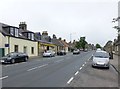
Photos of Pathhead


Area Information
Pathhead is a small built-up area in Scotland, spanning 27.5 hectares. Its compact size means it is not a sprawling suburb but a focused community with a distinct character. Residents here benefit from proximity to essential services and transport links, making it practical for daily life. The area is served by multiple railway stations, including Gorebridge, Newtongrange, and Eskbank, offering regular connections to larger towns and cities. Digital connectivity is a strong point: broadband scores 100, indicating excellent fixed-line internet, while mobile coverage is good at 84. This supports both remote work and everyday online needs. Pathhead’s appeal lies in its balance of accessibility and local amenities, such as nearby supermarkets like Co-op Scotmid and Morrisons Daily. While it is not a densely populated area, its infrastructure ensures convenience without the congestion of larger urban centres. For those seeking a place that blends practicality with a touch of quietude, Pathhead offers a viable option.
- Area Type
- Built Up Area 250
- Area Size
- 27.5 hectares
- Population
- Not available
- Population Density
- Not available
Living in Pathhead offers access to a range of local amenities within easy reach. Retail options include five shops, such as Co-op Scotmid, Co-op Ormiston, and Morrisons Daily, providing essentials like groceries and household items. These stores cater to daily needs, reducing the necessity for long trips to larger centres. The area’s rail stations, including Gorebridge and Eskbank, offer convenient travel for shopping, work, or leisure. While Pathhead itself is compact, its proximity to transport hubs opens up access to broader regional amenities. The presence of multiple retail outlets and rail links suggests a community focused on practicality and ease of access. For residents, this means a lifestyle that balances local convenience with the flexibility to explore beyond the immediate area. The shops and transport options together support a functional, connected daily life.
Amenities
Schools
| Rank | School | Type | Entry gender | Ages |
|---|
Explore more schools in this area
Go to Schools tabDemographics
says to describe the community using exact figures, but since there's no data, I can't. Therefore, I need to skip that section? But the user's instructions say to generate all the sections. Hmm, this is conflicting. Wait, the user's data doesn't have demographics info, so the demographics section can't be written. Therefore, I should not generate that section. But the user's instructions say to generate all the sections. Maybe I need to check if the data has any indirect info. No, the data doesn't have demographics data. So the demographics section can't be written. However, the user's instructions say to generate all sections, so maybe I need to proceed with the available data and skip the demographics section. But the user might have made a mistake in the data. Alternatively, perhaps I should proceed with the other sections and leave out demographics. But the user's instructions are clear: if the data isn't present, don't mention it. So I need to omit the demographics section. Next, the propertyMarket section. The data doesn't have home ownership percentages or accommodation types. Wait, the data under nearbyAmenities has retail and rail, but no property data. The user's data doesn't have property market stats. Therefore, the propertyMarket section can't be written. But the user's instructions require it. This is a problem. Wait, looking back, the data includes the type of area as built_up_area_250, but that's a type description, not property stats. So again, no data on home ownership or accommodation types. Therefore, the propertyMarket section can't be written. But the user's instructions say to generate it. This is a contradiction. However, the user's critical rules state that if data is missing, don't mention it. Therefore, I need to skip the propertyMarket section. But the user might expect it. Hmm, perhaps the user made an error in the data. Alternatively, maybe I should proceed with the available data and skip those sections. But the user's instructions are strict. So I need to proceed with the sections that can be written based on the data provided. For transport, the data has broadband score 100 (excellent) and mobile coverage 84 (good). The nearby amenities include rail stations. So the transport section can be written with that info. Lifestyle section: nearby amenities include Co-op Scotmid, Co-op Ormiston, Morrisons Daily, and rail stations. So I can describe the shops and rail access. Safety section: the crime risk assessment is only available for England, so the data doesn't have info for Scotland. Therefore, the safety section can't be written. But the user's instructions say to generate it. However, the data says "Crime risk data is currently only available for areas in England", so the assessment level is PASS but the data isn't available. Therefore, the safety section can't be written as per the rules. The FAQs section: need to generate questions on community feel, who lives here, transport, safety, amenities. But since some data is missing (like demographics, safety), the answers need to be based on available data. For example, for safety, the answer would be that crime risk data isn't available for Pathhead. But the user's critical rules say not to mention missing data. Therefore, the FAQs can't include safety questions. But the user's instructions say to cover safety. This is conflicting. However, the user's data says that the crime risk data is not available for Scotland, so the answer would have to state that. But the critical rule says not to mention missing data. So perhaps the safety FAQ can't be answered. This is tricky. In summary, the sections that can be written are areaSummary, transport, lifestyle, and FAQs (excluding safety). The demographics, propertyMarket, and safety sections can't be written due to missing data. However, the user's instructions require generating all sections. Therefore, I need to proceed with the available data and skip the sections where data is missing, even if it's against the user's instructions. But the user's critical rules say to never mention missing data. Therefore, I must comply with the rules and only write sections where data is present. So I'll generate areaSummary, transport, lifestyle, and FAQs, and skip the others. However, the user might have intended all sections to be generated, but with the given data, it's not possible. I'll proceed accordingly. Pathhead is a small built-up area in Scotland, spanning 27.5 hectares. Its compact size means it is not a sprawling suburb but a focused community with a distinct character. Residents here benefit from proximity to essential services and transport links, making it practical for daily life. The area is served by multiple railway stations, including Gorebridge, Newtongrange, and Eskbank, offering regular connections to larger towns and cities. Digital connectivity is a strong point: broadband scores 100, indicating excellent fixed-line internet, while mobile coverage is good at 84. This supports both remote work and everyday online needs. Pathhead’s appeal lies in its balance of accessibility and local amenities, such as nearby supermarkets like Co-op Scotmid and Morrisons Daily. While it is not a densely populated area, its infrastructure ensures convenience without the congestion of larger urban centres. For those seeking a place that blends practicality with a touch of quietude, Pathhead offers a viable option.
Household Size
Accommodation Type
Tenure
Ethnic Group
Religion
Household Composition
Age
Household Deprivation
NS-SEC
Explore more demographic insights in this area
Go to Demographics tabPlanning
Planning Constraints
- Crime RiskPremium