Area Overview for EH20 9PT
Photos of EH20 9PT


Area Information
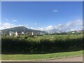
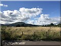
EH20 9PT represents a very specific residential cluster in the EH20 postcode area of Scotland. This location covers just 173 m² of space, indicating a compact neighbourhood rather than a sprawling district. Living in EH20 9PT means you are situated within a defined postal sector that serves as a gateway to Edinburgh's wider infrastructure. The area functions as a small, focused residential zone where daily life revolves around proximity to major employment hubs. You will find yourself close to significant transport nodes and retail facilities, making this postcode suitable for those who value convenience over spaciousness. The neighbourhood does not offer the green belts or open spaces typical of larger council estates. Instead, it is a dense point of contact for commuters. Your journey from this small footprint to major employment centres like Murrayfield Stadium or West End is short in terms of time. This constrained area size suggests that property prices might reflect the scarcity of land within this specific grid reference.
- Area Type
- Postcode
- Area Size
- 173 m²
- Population
- Not available
- Population Density
- Not available
There is no publicly accessible market data detailing home ownership percentages or the specific mix of accommodation types within EH20 9PT. You cannot determine if this is primarily an owner-occupied sector or a rental market based on current records. The property landscape is shrouded in a lack of specific statistics regarding tenancy rates, house prices, or average Sq M² valuations. Consequently, you must treat this neighbourhood as an unknown variable until survey data is released. The compact 173 m² area size hints at high-density living or shared spaces, but this remains speculative. Buyers seeking properties here face a challenge in understanding local vendor behaviour or rental yields without concrete numbers. The absence of official housing stock analysis means that decisions should be driven by location value rather than financial trends specific to this postcode. You cannot assess whether families own their homes near the rail stations or if the area is dominated by private landlords.
House Prices in EH20 9PT
Showing 2 properties
| Address | Type | Beds | Baths | Last Sale Price | Last Sale Date | |
|---|---|---|---|---|---|---|
| 2 Hillview Gardens, Loanhead, EH20 9PT | Semi-detached | 3 | 1 | - | - | |
| Nivensknowe Boarding Kennels, 1 Hillview Gardens, Loanhead, EH20 9PT | Detached | - | - | - | - |
Energy Efficiency in EH20 9PT
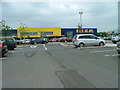
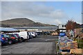
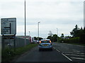
Your lifestyle in EH20 9PT is defined by access to major retail and transport hubs within practical reach. You have immediate access to five notable shopping options including Asda Straiton, Aldi Pentland Road, and Costco Edinburgh. These outlets provide comprehensive shopping capabilities for groceries, household goods, and big-ticket items. Public transport connectivity is strong with five rail stations nearby, including Eskbank Railway Station, Newtongrange Railway Station, and Shawfair Railway Station. You can easily commute to Edinburgh city centre or surrounding suburbs without needing a private vehicle. Cultural and leisure facilities are also nearby, with the Murrayfield Stadium, West End, and Balgreen all within reach. This concentration of amenities creates a convenient daily routine. You might walk to a station for work and reach your supermarket for essentials in the same day. The area does not require long journeys for daily necessities. The blend of retail giants and transport nodes ensures that essential services are never far away.
Amenities
Schools
| Rank | School | Type | Entry gender | Ages |
|---|
Explore more schools in this area
Go to Schools tabDemographics
Few statistical details regarding the community in EH20 9PT are currently available. Without data on age profiles, household types, or home ownership levels, you cannot determine the typical resident. The local administration has not published figures on diversity or demographics for this specific sector. These gaps prevent an assessment of whether the area caters to young families, students, or retirees. Because no information exists on household composition, you must rely on nearby amenities to infer the likely population. The proximity to Eskbank Railway Station and Newtongrange Railway Station suggests a commuter profile typical of surrounding districts. However, these are merely contextual observations. You cannot claim knowledge about the social fabric because the data is absent. Any description of the people living here would require an educated guess rather than a factual statement. This lack of clarity applies equally to employment rates and income levels.
Household Size
Accommodation Type
Tenure
Ethnic Group
Religion
Household Composition
Age
Household Deprivation
NS-SEC
Explore more demographic insights in this area
Go to Demographics tabPlanning
Planning Constraints
- Flood RiskPremium
- Ramsar Wetland SitesPremium
- Area of Outstanding Natural BeautyPremium
- Protected Nature ReservePremium
- Protected WoodlandPremium
- Crime RiskPremium