Area Overview for Bonnyrigg
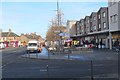
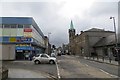
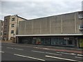
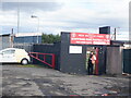
Photos of Bonnyrigg

Area Information
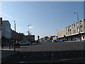
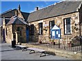
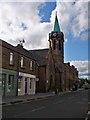
Bonnyrigg is a compact built-up area in Scotland, spanning 4.6 km². It is a town with a practical layout, offering residents a mix of urban convenience and community-focused living. The area’s proximity to rail stations and retail hubs makes it accessible for daily commutes and errands. With a focus on connectivity, residents benefit from strong digital infrastructure, which supports both work and leisure activities. While the population size is not specified, the area’s amenities suggest a balance between residential and commercial functions. Daily life in Bonnyrigg is shaped by its proximity to essential services, including multiple supermarkets and rail links, which cater to a range of needs. The town’s character is defined by its practicality, with a network of local shops and transport options that serve both residents and visitors. For those seeking a location that combines convenience with a sense of place, Bonnyrigg offers a straightforward, functional living environment.
- Area Type
- Built Up Area 250
- Area Size
- 4.6 km²
- Population
- Not available
- Population Density
- Not available
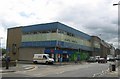
Residents of Bonnyrigg have access to a range of local amenities within practical reach. The area includes five retail outlets, such as Co-op Bonnyrigg, Tesco Rosewell, and Morrisons Daily, providing everyday shopping convenience. These stores cater to a variety of needs, from groceries to household essentials. The presence of multiple rail stations also enhances the area’s accessibility, allowing easy travel to nearby destinations. While the data does not specify parks or leisure facilities, the availability of shops and transport links suggests a lifestyle focused on practicality and ease of access. The combination of retail options and rail connectivity ensures that daily life in Bonnyrigg is efficient, with minimal need for long commutes or extensive travel.
Amenities
Schools
| Rank | School | Type | Entry gender | Ages |
|---|
Explore more schools in this area
Go to Schools tabDemographics
This section cannot be completed as the data does not include demographic details such as age profile, household types, home ownership levels, or diversity statistics.
Household Size
Accommodation Type
Tenure
Ethnic Group
Religion
Household Composition
Age
Household Deprivation
NS-SEC
Explore more demographic insights in this area
Go to Demographics tabPlanning
Planning Constraints
- Crime RiskPremium