Area Overview for ML2 8NL
Photos of ML2 8NL


Area Information
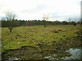
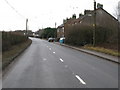
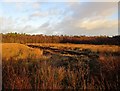
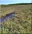
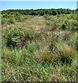
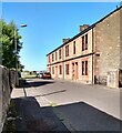
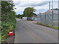
ML2 8NL is a small residential postcode area in Scotland, covering 913 square metres. It lies in a quiet, compact cluster of homes, offering a low-key alternative to busier urban centres. The area is well-served by rail connections, with Wishaw, Cleland, and Shieldmuir stations within easy reach, providing links to nearby towns and cities. For daily needs, residents have access to five retail outlets, including Morrisons Cambusnethan and Co-op Scotmid, ensuring convenience for shopping. The area’s compact size means it is likely to be surrounded by open spaces or rural landscapes, though specific details about nearby parks or green areas are not provided. Living here suits those who value proximity to transport and basic amenities without the density of larger towns. The broadband score of 97 indicates excellent fixed-line internet, while mobile coverage of 80 suggests reliable connectivity for most uses. With no significant environmental or planning constraints, ML2 8NL appears to be a practical choice for buyers seeking a straightforward, low-maintenance location.
- Area Type
- Postcode
- Area Size
- 913 m²
- Population
- Not available
- Population Density
- Not available
House Prices in ML2 8NL
Showing 4 properties
| Address | Type | Beds | Baths | Last Sale Price | Last Sale Date | |
|---|---|---|---|---|---|---|
| 2 Eastgate, Cambusnethan, Wishaw, ML2 8NL | Unknown | - | - | - | - | |
| 1 Eastgate, Cambusnethan, Wishaw, ML2 8NL | Bungalow | - | - | - | - | |
| 3 Eastgate, Cambusnethan, Wishaw, ML2 8NL | Bungalow | - | - | - | - | |
| Telephone Exchange, Eastgate, Cambusnethan, Wishaw, ML2 8NL | Office | - | - | - | - |
Energy Efficiency in ML2 8NL
The area’s proximity to retail and rail services shapes its lifestyle. Five retail outlets, including Morrisons Cambusnethan and Spar Certas, provide access to groceries, fuel, and everyday essentials. The rail network, with stations like Wishaw and Cleland, connects residents to broader regional hubs, enabling easy travel for work, shopping, or leisure. While specific details about dining or leisure spots are not provided, the presence of multiple retail options suggests a practical, community-focused environment. The compact size of ML2 8NL likely means it is bordered by open countryside or smaller villages, offering a balance between convenience and tranquillity. For those who value reliable transport and basic amenities without urban clutter, this area provides a functional, low-maintenance lifestyle.
Amenities
Schools
| Rank | School | Type | Entry gender | Ages |
|---|
Explore more schools in this area
Go to Schools tabDemographics
Household Size
Accommodation Type
Tenure
Ethnic Group
Religion
Household Composition
Age
Household Deprivation
NS-SEC
Explore more demographic insights in this area
Go to Demographics tabPlanning
Planning Constraints
- Flood RiskPremium
- Ramsar Wetland SitesPremium
- Area of Outstanding Natural BeautyPremium
- Protected Nature ReservePremium
- Protected WoodlandPremium
- Crime RiskPremium