Area Overview for ML2 8NJ
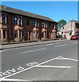
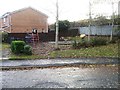
Photos of ML2 8NJ


Area Information
ML2 8NJ is a small, focused postcode area in Scotland, covering just 1.2 hectares. It is a residential cluster, likely centred on a few key streets or housing developments, offering a compact, close-knit environment. The area’s proximity to railway stations like Wishaw, Cleland, and Shieldmuir suggests it is well integrated with regional transport networks, making it accessible for commuters. Nearby retail options, including Morrisons Cambusnethan, Co-op Scotmid, and Spar Certas, provide everyday convenience. While the area is small, its connectivity to rail and retail hubs hints at a practical, functional lifestyle. Residents here are likely to value proximity to essential services and the ease of travel. The broadband score of 97 indicates excellent fixed-line internet quality, supporting remote work or online activities. Mobile coverage, rated 80, is good but not exceptional, which might be a consideration for those reliant on mobile data. The low flood risk and absence of protected natural sites suggest a stable, low-constraint environment for development and living.
- Area Type
- Postcode
- Area Size
- 1.2 hectares
- Population
- Not available
- Population Density
- Not available
House Prices in ML2 8NJ
Showing 35 properties
| Address | Type | Beds | Baths | Last Sale Price | Last Sale Date | |
|---|---|---|---|---|---|---|
| 143 Cambusnethan Street, Cambusnethan, Wishaw, ML2 8NJ | Retail | 4 | 1 | - | - | |
| 120 Cambusnethan Street, Cambusnethan, Wishaw, ML2 8NJ | Terraced | 2 | 1 | - | - | |
| 127 Cambusnethan Street, Cambusnethan, Wishaw, ML2 8NJ | Terraced | 3 | 2 | - | - | |
| 144 Cambusnethan Street, Cambusnethan, Wishaw, ML2 8NJ | Flat | 1 | 1 | - | - | |
| 88 Cambusnethan Street, Cambusnethan, Wishaw, ML2 8NJ | Flat | - | - | - | - | |
| 135 Cambusnethan Street, Cambusnethan, Wishaw, ML2 8NJ | Terraced | - | - | - | - | |
| 94 Cambusnethan Street, Cambusnethan, Wishaw, ML2 8NJ | Flat | - | - | - | - | |
| 131 Cambusnethan Street, Cambusnethan, Wishaw, ML2 8NJ | house | - | - | - | - | |
| 129 Cambusnethan Street, Cambusnethan, Wishaw, ML2 8NJ | house | - | - | - | - | |
| 139 Cambusnethan Street, Cambusnethan, Wishaw, ML2 8NJ | house | - | - | - | - |
Energy Efficiency in ML2 8NJ
Daily life in ML2 8NJ is shaped by its proximity to retail and rail amenities. The nearby Morrisons Cambusnethan, Co-op Scotmid, and Spar Certas provide a range of shopping options, from groceries to everyday essentials, reducing the need for long trips. For dining, while specific restaurants are not listed, the presence of multiple retail outlets suggests a modest selection of local eateries or cafes within walking distance. The area’s rail connections to Wishaw, Cleland, and Shieldmuir offer access to broader leisure opportunities, such as cultural events, parks, or shopping centres in nearby towns. The absence of major parks or recreational spaces in the immediate area means residents may need to travel slightly further for outdoor activities, though the nearby rail links could facilitate this. Overall, the lifestyle in ML2 8NJ balances practicality with limited local amenities, making it suitable for those prioritising convenience over expansive leisure options.
Amenities
Schools
| Rank | School | Type | Entry gender | Ages |
|---|
Explore more schools in this area
Go to Schools tabDemographics
Household Size
Accommodation Type
Tenure
Ethnic Group
Religion
Household Composition
Age
Household Deprivation
NS-SEC
Explore more demographic insights in this area
Go to Demographics tabPlanning
Planning Constraints
- Flood RiskPremium
- Ramsar Wetland SitesPremium
- Area of Outstanding Natural BeautyPremium
- Protected Nature ReservePremium
- Protected WoodlandPremium
- Crime RiskPremium