Area Overview for Ratho
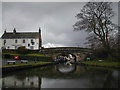
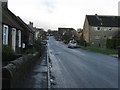
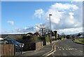
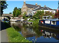
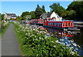
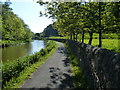
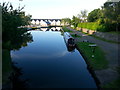
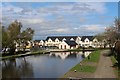
Photos of Ratho


Area Information
Ratho is a compact, well-connected built-up area in Scotland, spanning 62.4 hectares. Its strategic location near Edinburgh offers a blend of suburban tranquillity and urban accessibility. Residents benefit from proximity to Edinburgh Airport, with the airport’s entrance and nearby transport hubs like Ingliston Park & Ride providing seamless links to the city. The area’s digital connectivity is robust, with broadband and mobile coverage scores of 87 and 85 respectively—both excellent by any standard. This makes Ratho ideal for remote workers or those reliant on high-speed internet for daily tasks. The area’s charm lies in its practicality: it balances everyday convenience with a sense of community. Retailers such as Co-op Scotmid and Sainsburys cater to local needs, while rail stations like Edinburgh Gateway and Curriehill offer regular services to Edinburgh. For those who enjoy water-based travel, nearby piers at Hawes and Town provide access to ferry routes. Ratho’s mix of amenities and infrastructure makes it a compelling choice for those seeking a functional, well-served home.
- Area Type
- Built Up Area 250
- Area Size
- 62.4 hectares
- Population
- Not available
- Population Density
- Not available
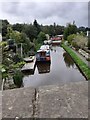
Living in Ratho offers a practical, accessible lifestyle with a range of amenities within walking or short driving distance. Retail options include Co-op Scotmid, M&S Ingliston, and Sainsburys, providing everyday essentials. The area’s proximity to Edinburgh Airport and rail stations like Edinburgh Gateway and Curriehill makes commuting straightforward. For leisure, the nearby Hawes Pier and Town Pier offer ferry access, while parks and open spaces are likely within the built-up area’s boundaries. The presence of multiple rail and metro stations, including Edinburgh Park and Gogarburn, supports both local and regional travel. This blend of retail, transport, and recreational options ensures daily life in Ratho is convenient, with minimal need to travel far for essentials. The area’s compact size and well-planned connectivity mean residents can enjoy a balanced mix of urban and suburban living without sacrificing accessibility.
Amenities
Schools
| Rank | School | Type | Entry gender | Ages |
|---|
Explore more schools in this area
Go to Schools tabDemographics
Household Size
Accommodation Type
Tenure
Ethnic Group
Religion
Household Composition
Age
Household Deprivation
NS-SEC
Explore more demographic insights in this area
Go to Demographics tabPlanning
Planning Constraints
- Crime RiskPremium