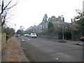
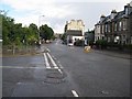
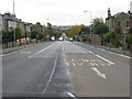
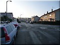
Area Overview for EH9 2DJ
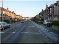
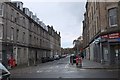
Photos of EH9 2DJ


Area Information
EH9 2DJ represents a specific postcode area covering a small residential cluster of 2,309 square metres. This compact footprint defines a distinct neighbourhood character within the broader greater Edinburgh landscape. Living in EH9 2DJ means residing in a defined zone that serves as a gateway to the city centre and northern suburbs. Residents enjoy immediate access to major thoroughfares while maintaining proximity to Edinburgh's historic core. The area sits within the city limits of Scotland, offering a balance of urban convenience and local community identity. You will find yourself close to transport hubs that connect you to Princes Street and St Andrew Square. Daily life here revolves around efficient access to essential services without the sprawl of distant housing estates. The location appeals to those who value short distances to workplaces and leisure venues. Homes in EH9 2DJ benefit from being situated near key rail stations such as Slateford Railway Station and Newcraighall Railway Station. This spatial organisation ensures that commuting times remain manageable for many households. The postcode area functions as a practical residential hub rather than a vast district. Its size dictates a tight-knit environment where local amenities are never far away. For anyone considering moving to this location, the primary advantage is its strategic positioning within Edinburgh's transport network.
- Area Type
- Postcode
- Area Size
- 2309 m²
- Population
- Not available
- Population Density
- Not available
The property market in EH9 2DJ is characterised by its compact size and specific housing configuration. This 2,309 square metre area limits the total number of homes available compared to wider districts. The housing stock comprises varied accommodation types typical of Edinburgh's residential developments. You will find a range of properties suitable for different budgets, though specific percentages of owner-occupied versus rental homes are not listed for this exact postcode. The nearest houses in EH9 2DJ benefit from being close to major High Streets like Cameron and Causewayside. Potential buyers often look for flats or houses near slateford railway station or newcraighall railway station for easy commutes. The market here reflects the demand for centrally located properties with strong amenity reach. Since the area is a small postcode cluster, inventory levels may fluctuate based on larger surrounding sales activity. Homes in EH9 2DJ command prices consistent with their proximity to the city centre and transport links. Whether you are looking to purchase a home or rent one, the location offers a defined residential zone within a high-demand region. The density of the housing stock means you will see a concentration of similar property styles in a small area. Buyers should expect competitive pricing for any homes that align with the accessibility of this postcode.
House Prices in EH9 2DJ
Showing 8 properties
| Address | Type | Beds | Baths | Last Sale Price | Last Sale Date | |
|---|---|---|---|---|---|---|
| 15 Mentone Gardens, Prestonfield, Edinburgh, EH9 2DJ | Flat | 2 | 2 | - | - | |
| 15A Mentone Gardens, Prestonfield, Edinburgh, EH9 2DJ | Terraced | 2 | 2 | - | - | |
| 4-6 Mentone Gardens, Prestonfield, Edinburgh, EH9 2DJ | undefined | - | - | - | - | |
| 2A Mentone Gardens, Prestonfield, Edinburgh, EH9 2DJ | Unknown | - | - | - | - | |
| 6 Mentone Gardens, Prestonfield, Edinburgh, EH9 2DJ | Maisonette | - | - | - | - | |
| 2F, 2 Mentone Gardens, Prestonfield, Edinburgh, EH9 2DJ | Maisonette | - | - | - | - | |
| 1F, 2 Mentone Gardens, Prestonfield, Edinburgh, EH9 2DJ | Unknown | - | - | - | - | |
| 7 Mentone Gardens, Prestonfield, Edinburgh, EH9 2DJ | Maisonette | - | - | - | - |
Energy Efficiency in EH9 2DJ
Your lifestyle in EH9 2DJ revolves around a dense cluster of retail and transport options. You can access five notable retail outlets including Sainsburys Cameron, Tesco Causewayside, and Aldi Newington. These shops sit within practical reach, allowing you to complete weekly grocery runs quickly. Five metro destinations lie nearby, offering easy transfer to Princes Street, St Andrew Square, and the West End. Rail connectivity is further strengthened by stations at Slateford Railway Station, Brunstane Railway Station, and Newcraighall Railway Station. A single ferry landing at Leith Newhaven Harbour provides an additional transport artery for residents. This network of amenities ensures that daily errands require minimal travel time. You will find a variety of dining and shopping choices just a short walk from home. The concentration of five retail locations and five metro points in the vicinity creates a convenient urban living experience. Whether you prefer local high streets or central city attractions, EH9 2DJ places you at the start of several short journeys.
Amenities
Schools
| Rank | School | Type | Entry gender | Ages |
|---|
Explore more schools in this area
Go to Schools tabDemographics
Living in EH9 2DJ involves joining a community defined by the specific housing stock available in this small residential cluster. While traditional demographic statistics such as age profiles or household composition are not provided for this precise postcode, the nature of the area suggests a mix of residents adapted to the local housing types. The 2,309 square metres of land must accommodate various accommodation types that serve different family needs and individual preferences. Home ownership levels in this sector determine whether you navigate a rental market or an owner-occupier community. Without specific figures on deprivation or income distribution, the neighbourhood character likely mirrors the broader trends of nearby areas in the city. Residents here rely on the surrounding amenities to shape their daily social lives. The lack of detailed population data means you cannot predict the exact age range or employment sectors of your neighbours. Instead, focus on how the housing typology influences community interaction. Whether you live in a flat or a detached home, the immediate environment around EH9 2DJ supports standard urban living. The area contains a cluster of properties that attract a diverse range of buyers seeking proximity to city attractions. Ultimately, the demographic experience depends on the specific building you choose within this small footprint.
Household Size
Accommodation Type
Tenure
Ethnic Group
Religion
Household Composition
Age
Household Deprivation
NS-SEC
Explore more demographic insights in this area
Go to Demographics tabPlanning
Planning Constraints
- Flood RiskPremium
- Ramsar Wetland SitesPremium
- Area of Outstanding Natural BeautyPremium
- Protected Nature ReservePremium
- Protected WoodlandPremium
- Crime RiskPremium