Area Overview for EH17 7NS
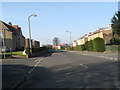
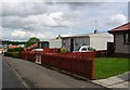
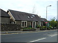
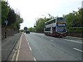
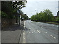
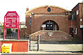
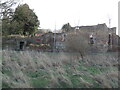
Photos of EH17 7NS


Area Information
Living in EH17 7NS defines a specific residential cluster spanning exactly 3063 square metres within Scotland. This postcode represents a compact environment where residents experience a tightly knit community rather than a sprawling district. The small physical footprint means that your daily commute often involves short distances to local services and neighbours who live just doors away. There are no large-scale commercial districts embedded within these boundaries, ensuring that your daily life revolves around quiet residential streets and immediate convenience. You will find this area serves as a calm sanctuary close to Edinburgh's broader urban infrastructure. The distinct separation between commercial zones and this housing cluster allows for a relaxed pace of life. Visitors to the neighbourhood typically note the absence of heavy traffic noise or overcrowding, which contributes to a peaceful atmosphere throughout the year. Homebuyers seeking a low-density living experience in a specific postcode designation will recognise EH17 7NS as a focused example of modern Scottish residential planning.
- Area Type
- Postcode
- Area Size
- 3063 m²
- Population
- Not available
- Population Density
- Not available
The property market in EH17 7NS reflects the unique nature of its housing stock within a small residential cluster. Buyers considering this postcode will find a range of accommodation types suited to the specific demands of modern living in Scotland. The limited total area influences the available land for development, leading to a market where value lies in existing structures and their immediate potential rather than vast lots. This constraint often results in a higher density of living spaces relative to the total area size. Reputable estate agents describe the available inventory as a curated selection of flats or houses that maximise the utility of the available ground. The market responds to a consistent demand from those seeking specific postcodes for investment or personal preference. Understanding the inventory density is crucial for anyone navigating the purchase process, as supply remains fixed by the geographical boundaries of this postcode.
House Prices in EH17 7NS
Showing 9 properties
| Address | Type | Beds | Baths | Last Sale Price | Last Sale Date | |
|---|---|---|---|---|---|---|
| 72 Craigour Crescent, Moredun, Edinburgh, EH17 7NS | Semi-detached | 3 | 3 | - | - | |
| 107 Craigour Crescent, Moredun, Edinburgh, EH17 7NS | Semi-detached | 2 | - | - | - | |
| 70 Craigour Crescent, Moredun, Edinburgh, EH17 7NS | Semi-detached | - | - | - | - | |
| 113 Craigour Crescent, Moredun, Edinburgh, EH17 7NS | Flat | - | - | - | - | |
| 105 Craigour Crescent, Moredun, Edinburgh, EH17 7NS | Unknown | - | - | - | - | |
| 111 Craigour Crescent, Moredun, Edinburgh, EH17 7NS | Unknown | - | - | - | - | |
| 109 Craigour Crescent, Moredun, Edinburgh, EH17 7NS | Unknown | - | - | - | - | |
| 115 Craigour Crescent, Moredun, Edinburgh, EH17 7NS | Unknown | - | - | - | - | |
| 74 Craigour Crescent, Moredun, Edinburgh, EH17 7NS | Semi-detached | - | - | - | - |
Energy Efficiency in EH17 7NS
Your lifestyle in EH17 7NS benefits from a wide array of amenities situated within practical reach, making daily errands convenient and enjoyable. The local retail scene includes a Co-op Scotmid and an Aldi Liberton, allowing you to stock your weekly groceries without leaving the immediate vicinity. M&S Edinburgh provides a regional shopping experience close to your doorstep, while five nearby railway stations including Shawfair, Newcraighall, and Brunstane offer flexible travel options. You can catch a ferry at Leith Newhaven Harbour for a short trip across the water. Access to St Andrew Square, Princes Street, and McDonald Road connects you to Edinburgh's heart without requiring a long commute. Five metro points provide easy access to the city centre, ensuring you can reach major attractions quickly. This blend of local shops and extensive transport networks means you can tailor your day between suburban comfort and urban excitement.
Amenities
Schools
| Rank | School | Type | Entry gender | Ages |
|---|
Explore more schools in this area
Go to Schools tabDemographics
The community within EH17 7NS consists of residents who have chosen this compact postcode for its specific location and characteristics. The demographic profile reflects a population drawn to the stability of living in a defined cluster within Scotland. Individuals selecting homes in this area prioritise proximity to established transport links and the quiet atmosphere that only a small residential cluster can provide. There is a clear focus on practicality among those who call EH17 7NS their home, as the immediate surroundings offer direct access to essential services without needing to travel far. The diversity of the neighbourhood mirrors the broader community needs of Scotland while maintaining a distinct local identity. People living here value the balance between seclusion and connectivity, ensuring they remain part of a wider network while enjoying privacy. The population density inherent in covering just 3063 square metres creates a sense of shared neighbourhood responsibility that is evident in daily interactions.
Household Size
Accommodation Type
Tenure
Ethnic Group
Religion
Household Composition
Age
Household Deprivation
NS-SEC
Explore more demographic insights in this area
Go to Demographics tabPlanning
Planning Constraints
- Flood RiskPremium
- Ramsar Wetland SitesPremium
- Area of Outstanding Natural BeautyPremium
- Protected Nature ReservePremium
- Protected WoodlandPremium
- Crime RiskPremium