Area Overview for EH14 2ST
Photos of EH14 2ST
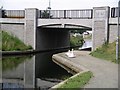
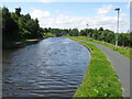
![Calder Road [A71], Edinburgh in EH14 2ST](https://images.propbar.co.uk/images/geograph/59/49/5949098_120.jpg)
100 photos from this area
Area Information
Key information about the EH14 2ST including its size, population, and administrative classification.
- Area Type
- Postcode
- Area Size
- 4.6 hectares
- Population
- Not available
- Population Density
- Not available
House Prices in EH14 2ST
4
Properties
-
Average Sold Price
-
Lowest Price
-
Highest Price
Showing 4 properties
| Address | Type | Beds | Baths | Last Sale Price | Last Sale Date | |
|---|---|---|---|---|---|---|
| Unit 14A, Westside Plaza Shopping Centre, 6 Westside Plaza, Hailesland, Edinburgh, EH14 2ST | shop | - | - | - | - | |
| 10 Westside Plaza, Hailesland, Edinburgh, EH14 2ST | Office | - | - | - | - | |
| Gala Bingo, 2 Westside Plaza, Hailesland, Edinburgh, EH14 2ST | assembly_leisure | - | - | - | - | |
| Wester Hailes Library, 1 Westside Plaza, Hailesland, Edinburgh, EH14 2ST | Office | - | - | - | - |
Energy Efficiency in EH14 2ST
Amenities
Schools
| Rank | School | Type | Entry gender | Ages |
|---|
Explore more schools in this area
Go to Schools tabDemographics
Household Size
N/A
most common
Accommodation Type
N/A
most common
Tenure
N/A
majority
Ethnic Group
N/A
most common
Religion
N/A
most common
Household Composition
N/A
most common
Age
N/A
median
N/A
most common
Household Deprivation
N/A
with no deprivation
NS-SEC
N/A
in Lower managerial occupations
Explore more demographic insights in this area
Go to Demographics tabPlanning
Planning Constraints
- Flood RiskPremium
- Ramsar Wetland SitesPremium
- Area of Outstanding Natural BeautyPremium
- Protected Nature ReservePremium
- Protected WoodlandPremium
- Crime RiskPremium