Area Overview for EH12 6UT
Photos of EH12 6UT


Area Information
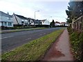
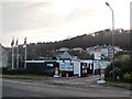
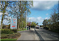
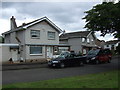
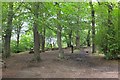
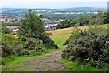
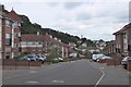
EH12 6UT is a small residential cluster in Scotland, covering just 6.3 hectares. Its compact size means it’s a tightly knit area, ideal for those seeking a quiet, focused community. The postcode is positioned near key transport hubs, including metro stations like Balgreen and Murrayfield Stadium, and rail links such as Edinburgh Gateway Railway Station. Residents benefit from proximity to Edinburgh Airport, with the main terminal just a short drive away. The area’s digital connectivity is exceptional, with a broadband score of 100, ensuring seamless internet access for remote work or entertainment. While mobile coverage is strong at 85, it’s slightly less than the highest possible score. The surrounding area is characterised by a mix of local amenities, including retail outlets like Co-op Scotmid and leisure spots such as Inchcolm Island Ferry Landing. This makes EH12 6UT a practical choice for those who value convenience without sacrificing the charm of a smaller, more manageable community.
- Area Type
- Postcode
- Area Size
- 6.3 hectares
- Population
- Not available
- Population Density
- Not available
House Prices in EH12 6UT
Showing 1 properties
| Address | Type | Beds | Baths | Last Sale Price | Last Sale Date | |
|---|---|---|---|---|---|---|
| Clerwood House, 96 Clermiston Road, Corstorphine, Edinburgh, EH12 6UT | shop | - | - | - | - |
Energy Efficiency in EH12 6UT
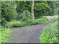
Living in EH12 6UT offers a blend of local convenience and regional accessibility. The area is served by five retail outlets, including Co-op Scotmid and Co-op Edinburgh - St John’s, ensuring daily essentials are within reach. Metro stations like Murrayfield Stadium provide easy access to sports and cultural events, while rail links connect to Edinburgh’s central areas. Residents can also take ferries from Leith Newhaven Harbour or Hawes Pier, offering scenic routes to Inchcolm Island and beyond. The proximity to Edinburgh Airport makes travel straightforward, and the surrounding area includes parks and open spaces, though specific names are not listed in the data. This mix of retail, transport, and leisure options creates a practical, well-connected lifestyle for residents.
Amenities
Schools
| Rank | School | Type | Entry gender | Ages |
|---|
Explore more schools in this area
Go to Schools tabDemographics
Household Size
Accommodation Type
Tenure
Ethnic Group
Religion
Household Composition
Age
Household Deprivation
NS-SEC
Explore more demographic insights in this area
Go to Demographics tabPlanning
Planning Constraints
- Flood RiskPremium
- Ramsar Wetland SitesPremium
- Area of Outstanding Natural BeautyPremium
- Protected Nature ReservePremium
- Protected WoodlandPremium
- Crime RiskPremium