Area Overview for EH11 2EB
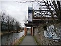
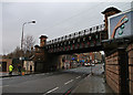
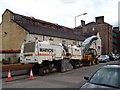
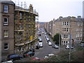
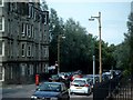
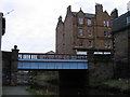
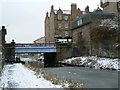
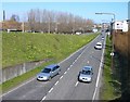
Photos of EH11 2EB


Area Information
Living in EH11 2EB offers a compact residential experience centred on a tiny landmass of just 2452 square metres. This specific postcode cluster functions as a focused point within Edinburgh, Scotland, rather than a sprawling neighbourhood. The area is defined by its small scale and strategic location near significant urban landmarks. Residents enjoy immediate proximity to major transport hubs and commercial zones without needing extensive travel. The setting is practical and efficient, catering to those who value direct access to city life. Families, professionals, and commuters often gravitate toward this postcode due to its connectivity. Daily life here involves quick trips to retail parks and rail stations. The area serves as a residential anchor for people working in central Edinburgh or attending events at nearby venues. Because the space is so confined, the character of the neighbourhood relies heavily on the surrounding streets and nearby facilities. You will find yourself surrounded by the energetic pulse of the city just moments away from your front door. This layout suits buyers seeking convenience over extensive gardens or large plots. The essence of EH11 2EB is its integration into the wider metropolitan fabric. It is a place where local life connects directly with the broader opportunities of Edinburgh. Whether you manage a small household or a busy schedule, the compact nature of this postcode ensures that essential services remain within reach. You gain a home that is close to action while maintaining a clear residential identity.
- Area Type
- Postcode
- Area Size
- 2452 m²
- Population
- Not available
- Population Density
- Not available
The property market in EH11 2EB is shaped by the physical constraints of its size and the high rate of home ownership. With 63 per cent of residents owning their homes, the area functions largely as an owner-occupied patch. This level of ownership suggests that many households have settled down and are invested in the locality. It indicates a stable market where sellers and buyers often interact with the knowledge of long-term residency. The housing stock in such a small 2452 square metre postcode cluster naturally consists of space-efficient units. Most homes are likely flats or urban-style residences designed to fit into tight city constraints. Large detached houses are improbable given the limited area size. The low number of people-per-household, where 60 per cent of homes hold one or two occupants, confirms that these properties are sized for smaller families or single residents. Buyers looking at this area should expect a market driven by demand from professionals and couples. The high ownership rate means you may encounter well-maintained properties with established value. Rental demand might also exist for the 37 per cent of households that do not own their homes. This mix creates a dynamic environment where property values are supported by local ownership stability and the convenience of nearby transport links.
House Prices in EH11 2EB
Showing 37 properties
| Address | Type | Beds | Baths | Last Sale Price | Last Sale Date | |
|---|---|---|---|---|---|---|
| 2F1, 187 Dalry Road, Dalry, Edinburgh, EH11 2EB | Flat | 1 | 1 | - | - | |
| 3F2, 169 Dalry Road, Dalry, Edinburgh, EH11 2EB | Flat | 1 | 1 | - | - | |
| 3F3, 179 Dalry Road, Dalry, Edinburgh, EH11 2EB | Unknown | - | - | - | - | |
| 3F1, 169 Dalry Road, Dalry, Edinburgh, EH11 2EB | Flat | - | - | - | - | |
| 1F3, 179 Dalry Road, Dalry, Edinburgh, EH11 2EB | Flat | - | - | - | - | |
| 2F1, 179 Dalry Road, Dalry, Edinburgh, EH11 2EB | Flat | - | - | - | - | |
| 3F1, 179 Dalry Road, Dalry, Edinburgh, EH11 2EB | Flat | - | - | - | - | |
| 2F3, 161 Dalry Road, Dalry, Edinburgh, EH11 2EB | Flat | - | - | - | - | |
| 2F3, 179 Dalry Road, Dalry, Edinburgh, EH11 2EB | Flat | - | - | - | - | |
| 3F1, 161 Dalry Road, Dalry, Edinburgh, EH11 2EB | Unknown | - | - | - | - |
Energy Efficiency in EH11 2EB
Daily life in EH11 2EB is supported by a dense network of amenities located just outside the postcode boundary. You can visit Co-op Edinburgh, Lidl Dalry, and Sainsburys Edinburgh to meet your shopping needs. These retail outlets provide fresh food, groceries, and household essentials within easy reach. Supermarkets serve the majority of residents, eliminating the need for long trips to distant shopping centres. Transport hubs are plentiful, with five metro points including West End and Murrayfield Stadium offering public transport links. Rail passengers can utilize Slateford, Kingsknowe, and South Gyle Railway Stations for faster journeys beyond Edinburgh. Five metro stations and five railway stations provide multiple commute options throughout the year. This density ensures you can travel quickly to business districts or leisure spots without relying solely on cars. Sports fans have the Murrayfield Stadium nearby, a major venue for rugby and other events. Frequent visitors might also explore Princes Street, a famous high street packed with shops and restaurants. For those seeking adventure, the Leith Newhaven Harbour Ferry Landing offers a shortcut to Leith. Access to Edinburgh Airport is provided through two nearby entrances, facilitating easy air travel. The combination of retail chains, transport nodes, and leisure venues creates a convenient urban experience.
Amenities
Schools
| Rank | School | Type | Entry gender | Ages |
|---|
Explore more schools in this area
Go to Schools tabDemographics
The community within EH11 2EB is characterised by its specific household composition and accommodation scale. The available data indicates that 60 per cent of households in this area consist of only one or two people. This figure highlights a demographic leaning toward individuals or couples rather than large families living together. Consequently, the character of the neighbourhood reflects the needs of singles, couples, and small households seeking efficient living spaces. Home ownership stands at a rate of 63 per cent for residents here. This statistic suggests a predominantly owner-occupied environment where long-term stability is common among those who call this postcode home. The remaining households likely occupy rental properties or shared accommodations. The accommodation types available must therefore cater to smaller groups, often found in flats or converted spaces typical of high-density urban clusters. There is no deprivation data available for this specific postcode, so direct comparisons regarding income levels or local wealth cannot be made using the current figures. Instead, the demographic profile points to a stable population with a strong tendency toward owning their homes. The presence of single-person and couple households indicates a demand for compact, well-located dwellings. You can expect a community of residents who have chosen this specific spot for its accessibility and their personal preference for smaller living units.
Household Size
Accommodation Type
Tenure
Ethnic Group
Religion
Household Composition
Age
Household Deprivation
NS-SEC
Explore more demographic insights in this area
Go to Demographics tabPlanning
Planning Constraints
- Flood RiskPremium
- Ramsar Wetland SitesPremium
- Area of Outstanding Natural BeautyPremium
- Protected Nature ReservePremium
- Protected WoodlandPremium
- Crime RiskPremium