Area Overview for EH11 1SA
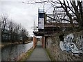
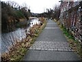
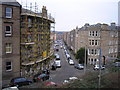
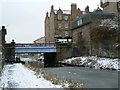
Photos of EH11 1SA


Area Information
EH11 1SA is a small, residential postcode cluster in Scotland, positioned near Edinburgh’s urban sprawl but with a distinct local character. The area benefits from excellent digital connectivity, with a broadband score of 92 and mobile coverage scoring 85, both indicating high-quality service. This makes it appealing for remote workers and those prioritising reliable internet. The area’s proximity to Edinburgh Airport and Leith Newhaven Harbour adds to its accessibility, while nearby amenities like Murrayfield Stadium and Co-op Scotmid stores provide convenience. The low flood risk and absence of protected natural sites suggest a stable, low-constraint environment. Though small, the area is served by multiple railway stations, including Slateford and Wester Hailes, linking residents to Edinburgh’s transport network. Living here offers a blend of suburban tranquillity and easy access to city amenities, making it suitable for families and professionals seeking balance. The compact nature of the postcode means the community is tightly knit, with local shops and services within walking distance.
- Area Type
- Postcode
- Area Size
- Not available
- Population
- Not available
- Population Density
- Not available
House Prices in EH11 1SA
No properties found in this postcode.
Energy Efficiency in EH11 1SA
EH11 1SA offers a mix of retail and leisure options within practical reach. Local shops include Co-op Scotmid and Lidl Craiglockhart, providing everyday essentials. The area’s proximity to Murrayfield Stadium and Balgreen adds recreational value, while nearby parks and open spaces are accessible via short trips. Residents can access Edinburgh’s cultural hubs, including the West End, which hosts theatres and cafes. The ferry service to Leith Newhaven connects to Edinburgh’s waterfront, offering leisure opportunities. With multiple railway stations and proximity to the city, daily life balances local convenience with urban access. The compact nature of the postcode means amenities are walkable, fostering a community-oriented lifestyle.
Amenities
Schools
| Rank | School | Type | Entry gender | Ages |
|---|
Explore more schools in this area
Go to Schools tabDemographics
Household Size
Accommodation Type
Tenure
Ethnic Group
Religion
Household Composition
Age
Household Deprivation
NS-SEC
Explore more demographic insights in this area
Go to Demographics tabPlanning
Planning Constraints
- Flood RiskPremium
- Ramsar Wetland SitesPremium
- Area of Outstanding Natural BeautyPremium
- Protected Nature ReservePremium
- Protected WoodlandPremium
- Crime RiskPremium