Area Overview for EH10 7ED
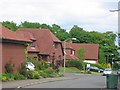
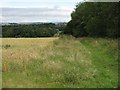
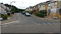
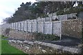
Photos of EH10 7ED


Area Information
EH10 7ED is a small, tightly defined residential postcode in Scotland, characterised by its compact footprint and proximity to key urban hubs. This area is part of a broader residential cluster that balances suburban tranquillity with access to essential services. The presence of multiple rail stations, including Slateford, Kingsknowe, and Wester Hailes, underscores its connectivity to Edinburgh’s transport network. Residents benefit from a range of retail options, such as Sainsburys Edinburgh and Morrisons Oxgangs, while the nearby Leith Newhaven Harbour Ferry Landing provides direct links to the city’s waterfront. The area’s appeal lies in its blend of practicality and convenience, offering residents a mix of local amenities and easy access to larger urban centres. With a focus on residential living, EH10 7ED caters to those seeking a stable, community-oriented environment without sacrificing accessibility. The absence of major planning constraints or environmental restrictions further enhances its appeal for homebuyers prioritising low risk and straightforward development.
- Area Type
- Postcode
- Area Size
- Not available
- Population
- Not available
- Population Density
- Not available
House Prices in EH10 7ED
No properties found in this postcode.
Energy Efficiency in EH10 7ED
Daily life in EH10 7ED is enriched by a selection of nearby amenities that cater to everyday needs. Retail options include Sainsburys Edinburgh, Morrisons Oxgangs, and Aldi Oxgangs, providing access to groceries and household essentials. The area’s proximity to Murrayfield Stadium and West End highlights its connection to cultural and sporting events, while the Balgreen metro stop offers links to Edinburgh’s broader leisure and entertainment scene. The Leith Newhaven Harbour Ferry Landing adds a maritime dimension, enabling trips to the city’s waterfront and beyond. These amenities collectively create a convenient, self-contained lifestyle, where residents can easily access shopping, transport, and recreational opportunities without needing to travel far. The mix of local and regional connectivity ensures a balanced approach to convenience and community engagement.
Amenities
Schools
| Rank | School | Type | Entry gender | Ages |
|---|
Explore more schools in this area
Go to Schools tabDemographics
Household Size
Accommodation Type
Tenure
Ethnic Group
Religion
Household Composition
Age
Household Deprivation
NS-SEC
Explore more demographic insights in this area
Go to Demographics tabPlanning
Planning Constraints
- Flood RiskPremium
- Ramsar Wetland SitesPremium
- Area of Outstanding Natural BeautyPremium
- Protected Nature ReservePremium
- Protected WoodlandPremium
- Crime RiskPremium