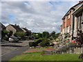
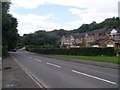
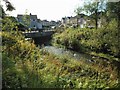
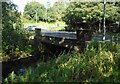
Area Overview for Kirkintilloch
Photos of Kirkintilloch


Area Information
Kirkintilloch is a built-up area of nearly 8.3 square kilometres located in Scotland. It functions as a distinct town within the local landscape, offering residents a defined community setting. The area provides a solid foundation for those seeking to settle in this part of the region. Daily life here revolves around specific local hubs and nearby transport links that connect you to wider opportunities. You find yourself in an environment where practical amenities are within easy reach. The town stands out for its established infrastructure and connectivity options. Living in Kirkintilloch means having access to five retail outlets and five railway stations nearby. This density of services supports a routine that avoids the need for long commutes to essentials. You can walk or drive quickly to the Spar and Sainsburys located in Kirkintilloch. Commuters also benefit from direct routes via Lenzie Railway Station, Stepps Railway Station, and Robroyston Railway Station. These stations serve as key arteries for travel beyond the immediate locality. The area size suggests a compact town feel where distances are manageable. You will appreciate how quickly you can navigate from your home to a shop or station. This layout supports both local shopping trips and daily travel requirements effectively. For those considering homes in Kirkintilloch, the physical scale of the town ensures that nothing feels isolated. The eighty-three square kilometres of recorded footprint define the boundaries of your potential neighbourhood. You gain access to a structured urban environment that balances residential space with essential services. The town centre and surrounding streets form the core of your daily routine. This established pattern of life has developed over time to meet the needs of current residents. You can expect a familiar rhythm where local businesses and transport schedules operate reliably. The combination of retail presence and rail access makes this a practical choice for many families.
- Area Type
- Built Up Area 250
- Area Size
- 8.3 km²
- Population
- Not available
- Population Density
- Not available
Your daily lifestyle in Kirkintilloch revolves around a practical mix of retail and transport amenities. Five retail outlets lie within practical reach, ensuring you can shop for groceries and essentials without straying far from home. You will find a Spar and Farmfoods Hayston close by for quick purchases. Sainsburys Kirkintilloch offers a larger supermarket experience for bulk shopping and weekly provisions. These stores anchor the local commercial activity and serve as reliable fixtures in your routine. You do not need to travel to a distant mall for your basic daily goods. Transport convenience defines the leisure and commute balance in this town. Five railway stations provide multiple departure points for your journeys. Lenzie Railway Station, Stepps Railway Station, and Robroyston Railway Station offer flexible options for your morning commute. You can choose the station nearest to your home to save time each day. This variety prevents bottlenecks and reduces stress during busy travel hours. The rail network connects you swiftly to Glasgow, giving you access to cinemas, restaurants, and nightlife beyond the town limits. Living in Kirkintilloch blends local community life with wider city access. You can sample localOff-the-shelf goods while retaining the option to visit the nearby cities for special occasions. The proximity of these five stations means you rarely feel cut off from national travel. The town supports a routine where you can leave your house, visit a local shop, or head to a train station with equal ease. You enjoy the convenience of knowing exactly where the Spar or Sainsburys is located. This layout encourages a balanced life that works well for families and professionals alike.
Amenities
Schools
| Rank | School | Type | Entry gender | Ages |
|---|
Explore more schools in this area
Go to Schools tabDemographics
The local population in this Scottish built-up area reflects a typical mix of household types found in many towns. While specific percentages for age groups or ownership levels are not detailed in the current records, the presence of local schools indicates a significant family presence. Schools near Kirkintilloch suggest that many households include children requiring education services. You will see families integrating into the community alongside other residents. The nature of amenities like Spar and Farmfoods Hayston caters to a broad demographic with varied shopping needs. Households in this area likely reflect standard UK patterns of ownership and renting. The availability of five railway stations across the nearby network implies a transport-dependent community, which often includes commuters and students. You find yourself part of a community where daily life revolves around reliable connections to work and education. The town supports a range of living arrangements from single-person homes to larger family properties. Diversity in the population is evident through the variety of services and transport links available to you. Residents here utilize the five nearby retail outlets for their weekly shopping requirements. The demographic mix ensures that local services remain relevant to different age groups and lifestyles. When considering what it means to live here, you join a community defined by practicality and routine. The 8.3 square kilometre area hosts these varied households in a compact setting. You do not need to travel far to find support networks or social groups. The presence of multiple railway stations suggests a population accustomed to moving between the town and surrounding regions. This mobility shapes the character of the neighbourhood and influences how people spend their time. Whether you see yourself as a commuter, a student, or a local retiree, the infrastructure accommodates your needs. The specific locations of amenities like Sainsburys Kirkintilloch serve as gathering points or daily stops. This density creates a sense of shared daily life among the residents.
Household Size
Accommodation Type
Tenure
Ethnic Group
Religion
Household Composition
Age
Household Deprivation
NS-SEC
Explore more demographic insights in this area
Go to Demographics tabPlanning
Planning Constraints
- Crime RiskPremium