Area Overview for Dunbartonshire
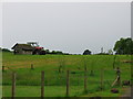
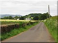
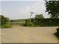
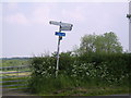
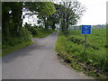
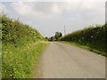
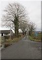
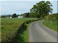
Photos of Dunbartonshire


Area Information
Living in Dunbartonshire offers a connection to Scotland's historic lowlands with a distinct geographical character spread across 857.8 km². This ceremonial county lies north of the River Clyde and borders Perthshire to the north, Stirlingshire to the east, and Argyllshire to the west. Although local government reforms in 1975 divided the territory among East Dunbartonshire, West Dunbartonshire, Argyll and Bute, and North Lanarkshire councils, the region persists as a lieutenancy area. Elected county councils based in Dumbarton existed from 1890 until 1973, when the area became part of the Strathclyde Region. The land is split into two primary sections. The main area sits north and west of Glasgow along the north shore of the Firth of Clyde. Residents enjoy a setting where administrative history meets modern life. The boundaries were finalised by Boundary Commissioners in 1891, with Commissioners of Supply established as far back as 1667. You can find homes in Dunbartonshire within a landscape defined by these long-standing local government structures. Whether you view properties near Loch Lomond or within the council areas, the region retains its identity as a historic county. The area covers 331 square miles, providing space that feels vast compared to urban centres yet remains accessible. The transfer of estates across borders in the 13th century shaped the rural character you experience today. ### Demographic data for Dunbartonshire is not available in the current records. Specific figures regarding age profiles, household types, and home ownership levels remain absent. You cannot rely on exact percentages for deprivation or diversity when official statistics are missing. Without concrete numbers, generalisations about the community fabric lack factual support. The absence of data means you cannot determine the precise balance between family households and single-person homes. Housing stock details, such as the proportion of terraced, semi-detached, and detached properties, are also unavailable. You lack information on whether the majority of residents live in accommodation they own or rent. This gap prevents a clear picture of the area's social structure. Deprivation metrics, which usually highlight areas needing extra support, cannot be evaluated here. Diversity statistics, including the percentage of residents from ethnic minorities, are similarly unreported. ### Information regarding the property market in Dunbartonshire is currently unavailable. You cannot access data on home ownership percentages or average house prices. Details on the ratio of first-time buyers to investors remain unreported. Specific figures for terraced, semi-detached, and detached homes are also missing. Without these statistics, buyers cannot assess whether this is an owner-occupied region or a rental-dominated zone. Data on property values, quarterly trends, and recent sales volumes is not included in the available information. You cannot compare Dunbartonshire to neighbouring areas using specific price points. The market type, whether characterised by council homes or private developments, is unclear. Buyers seeking to understand competition levels or investment potential lack the necessary metrics. Housing stock types, from flat conversions to detached suburbs, are described only by the absence of data. You must view listings without the context of broader market trends. While you can browse homes in Dunbartonshire, statistical analysis of the sector is impossible without further information. ### Digital connectivity for residents in Dunbartonshire shows a mobile coverage score of 84 out of 100. This level indicates good mobile network quality throughout most of the region. You can expect reliable signal strength for daily internet use and mobile communications. The high score suggests that working from home is feasible across much of the territory. Broadband specifics are not provided, but the mobile infrastructure supports contemporary digital needs effectively. Residents benefit from robust mobile networks while living in this historic county. The 84 score outperforms average connectivity measures found in remote rural locations. You do not need to worry about signal dead zones during standard commuting hours. The infrastructure supports video calls, streaming services, and fast data uploads reliably. For professionals who rely on constant connection, Dunbartonshire offers adequate digital coverage. The quality index avoids the lowest tiers of network performance found in other parts of the UK. ### Crime risk cannot be assessed for Dunbartonshire because data is currently only available for areas in England. No safety metrics exist for this Scottish ceremonial county. You cannot calculate a risk score or identify crime hotspots based on official statistics. Environmental considerations and other non-crime risks are also not quantified in the provided information. Residents cannot compare Dunbartonshire safety against national averages using specific benchmarks. The absence of assessment data means you must rely on general knowledge or local inquiry. Official levels for low, medium, or high risk are not applicable here. Practical terms for residents remain undefined by official assessment frameworks. ### What communities make up Dunbartonshire?Dunbartonshire consists of diverse council areas including East Dunbartonshire, West Dunbartonshire, Argyll and Bute, and North Lanarkshire. It spans 857.8 km² across the west central Lowlands of Scotland. How is connectivity for working from home?Living in Dunbartonshire offers a digital mobile coverage score of 84 out of 100. This indicates good network quality suitable for reliable remote work and daily internet use. Is the area safe to live in?Official crime risk assessments are only available for areas in England. Therefore, specific safety data for Dunbartonshire is not currently accessible or reported.
- Area Type
- Ceremonial Counties Region
- Area Size
- 857.8 km²
- Population
- Not available
- Population Density
- Not available
Demographics
Demographic data for Dunbartonshire is not available in the current records. Specific figures regarding age profiles, household types, and home ownership levels remain absent. You cannot rely on exact percentages for deprivation or diversity when official statistics are missing. Without concrete numbers, generalisations about the community fabric lack factual support. The absence of data means you cannot determine the precise balance between family households and single-person homes. Housing stock details, such as the proportion of terraced, semi-detached, and detached properties, are also unavailable. You lack information on whether the majority of residents live in accommodation they own or rent. This gap prevents a clear picture of the area's social structure. Deprivation metrics, which usually highlight areas needing extra support, cannot be evaluated here. Diversity statistics, including the percentage of residents from ethnic minorities, are similarly unreported. ### Information regarding the property market in Dunbartonshire is currently unavailable. You cannot access data on home ownership percentages or average house prices. Details on the ratio of first-time buyers to investors remain unreported. Specific figures for terraced, semi-detached, and detached homes are also missing. Without these statistics, buyers cannot assess whether this is an owner-occupied region or a rental-dominated zone. Data on property values, quarterly trends, and recent sales volumes is not included in the available information. You cannot compare Dunbartonshire to neighbouring areas using specific price points. The market type, whether characterised by council homes or private developments, is unclear. Buyers seeking to understand competition levels or investment potential lack the necessary metrics. Housing stock types, from flat conversions to detached suburbs, are described only by the absence of data. You must view listings without the context of broader market trends. While you can browse homes in Dunbartonshire, statistical analysis of the sector is impossible without further information. ### Digital connectivity for residents in Dunbartonshire shows a mobile coverage score of 84 out of 100. This level indicates good mobile network quality throughout most of the region. You can expect reliable signal strength for daily internet use and mobile communications. The high score suggests that working from home is feasible across much of the territory. Broadband specifics are not provided, but the mobile infrastructure supports contemporary digital needs effectively. Residents benefit from robust mobile networks while living in this historic county. The 84 score outperforms average connectivity measures found in remote rural locations. You do not need to worry about signal dead zones during standard commuting hours. The infrastructure supports video calls, streaming services, and fast data uploads reliably. For professionals who rely on constant connection, Dunbartonshire offers adequate digital coverage. The quality index avoids the lowest tiers of network performance found in other parts of the UK. ### Crime risk cannot be assessed for Dunbartonshire because data is currently only available for areas in England. No safety metrics exist for this Scottish ceremonial county. You cannot calculate a risk score or identify crime hotspots based on official statistics. Environmental considerations and other non-crime risks are also not quantified in the provided information. Residents cannot compare Dunbartonshire safety against national averages using specific benchmarks. The absence of assessment data means you must rely on general knowledge or local inquiry. Official levels for low, medium, or high risk are not applicable here. Practical terms for residents remain undefined by official assessment frameworks. ### What communities make up Dunbartonshire?Dunbartonshire consists of diverse council areas including East Dunbartonshire, West Dunbartonshire, Argyll and Bute, and North Lanarkshire. It spans 857.8 km² across the west central Lowlands of Scotland. How is connectivity for working from home?Living in Dunbartonshire offers a digital mobile coverage score of 84 out of 100. This indicates good network quality suitable for reliable remote work and daily internet use. Is the area safe to live in?Official crime risk assessments are only available for areas in England. Therefore, specific safety data for Dunbartonshire is not currently accessible or reported.
Household Size
Accommodation Type
Tenure
Ethnic Group
Religion
Household Composition
Age
Household Deprivation
NS-SEC
Explore more demographic insights in this area
Go to Demographics tabPlanning
Planning Constraints
- Crime RiskPremium