Area Overview for Garelochhead
Photos of Garelochhead
Area Information
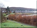
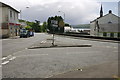
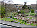
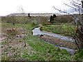
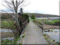
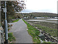
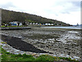
Garelochhead is a small built-up area in Scotland, covering 45.6 hectares. Its compact size gives it a close-knit feel, with residents often knowing their neighbours. The area is served by Garelochhead Railway Station, offering direct rail links to nearby towns, which makes commuting to larger cities like Glasgow or Edinburgh feasible. Within practical reach, residents have access to two retail outlets: Spar and Co-op Rosneath, providing essential shopping options. While the broadband connectivity score is low at 27, mobile coverage is better, scoring 74, which supports basic digital needs. Garelochhead’s proximity to natural landscapes and its modest infrastructure suggest it caters to those seeking a quiet, community-focused lifestyle. The area’s character is defined by its blend of rural tranquillity and accessible amenities, making it appealing to families and individuals looking for a slower pace of life without being isolated from essential services.
- Area Type
- Built Up Area 250
- Area Size
- 45.6 hectares
- Population
- Not available
- Population Density
- Not available
Daily life in Garelochhead is shaped by its proximity to essential amenities. The Spar and Co-op Rosneath stores provide access to groceries, fuel, and everyday essentials, reducing the need for long trips. The Garelochhead Railway Station enhances mobility, connecting residents to nearby towns and cities for work, shopping, or leisure. While the area’s small size means limited entertainment options, its rural surroundings likely offer opportunities for outdoor activities. The combination of retail convenience and transport links creates a functional lifestyle, ideal for those prioritising simplicity and accessibility over urban vibrancy.
Amenities
Schools
| Rank | School | Type | Entry gender | Ages |
|---|
Explore more schools in this area
Go to Schools tabDemographics
Household Size
Accommodation Type
Tenure
Ethnic Group
Religion
Household Composition
Age
Household Deprivation
NS-SEC
Explore more demographic insights in this area
Go to Demographics tabPlanning
Planning Constraints
- Crime RiskPremium