Area Overview for G81 2XT
Photos of G81 2XT


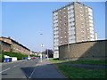
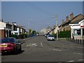


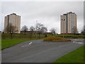

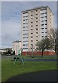

64 photos from this area
Area Information
Key information about the G81 2XT including its size, population, and administrative classification.
- Area Type
- Postcode
- Area Size
- 17.1 hectares
- Population
- Not available
- Population Density
- Not available
House Prices in G81 2XT
7
Properties
-
Average Sold Price
-
Lowest Price
-
Highest Price
Showing 7 properties
| Address | Type | Beds | Baths | Last Sale Price | Last Sale Date | |
|---|---|---|---|---|---|---|
| Hungry Horse, Great Western Road, Clydebank, G81 2XT | Restaurant | - | - | - | - | |
| Atm, 2333 Great Western Road, Clydebank, G81 2XT | Retail | - | - | - | - | |
| World Of Golf, Golf Driving Range, 2700 Great Western Road, Clydebank, G81 2XT | Leisure | - | - | - | - | |
| Shop, 2700 Great Western Road, Clydebank, G81 2XT | shop | - | - | - | - | |
| Boulevard Hotel, Great Western Road, Clydebank, G81 2XT | hotel | - | - | - | - | |
| West Highway Service Station, 2333 Great Western Road, Clydebank, G81 2XT | Retail | - | - | - | - | |
| Goals Soccer Centre Ltd, Goals, 2650 Great Western Road, Clydebank, G81 2XT | Leisure | - | - | - | - |
Energy Efficiency in G81 2XT
Amenities
Schools
| Rank | School | Type | Entry gender | Ages |
|---|
Explore more schools in this area
Go to Schools tabDemographics
Household Size
N/A
most common
Accommodation Type
N/A
most common
Tenure
N/A
majority
Ethnic Group
N/A
most common
Religion
N/A
most common
Household Composition
N/A
most common
Age
N/A
median
N/A
most common
Household Deprivation
N/A
with no deprivation
NS-SEC
N/A
in Lower managerial occupations
Explore more demographic insights in this area
Go to Demographics tabPlanning
Planning Constraints
- Flood RiskPremium
- Ramsar Wetland SitesPremium
- Area of Outstanding Natural BeautyPremium
- Protected Nature ReservePremium
- Protected WoodlandPremium
- Crime RiskPremium