Area Overview for G68 0BL
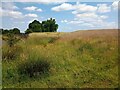
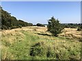
Photos of G68 0BL


Area Information
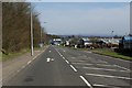
Living in G68 0BL means being part of a small, focused residential cluster in central Scotland. This postcode area is compact, with a quiet, community-oriented feel that suits those seeking a balance between convenience and tranquillity. Proximity to rail networks, including Cumbernauld, Greenfaulds, and Croy stations, ensures easy access to nearby towns and cities, making it practical for commuters. Retail options are accessible, with Aldi, Spar, and other local stores within walking distance, supporting daily needs. The area’s digital connectivity is strong, with broadband and mobile scores of 82 and 80 respectively, reflecting good quality for both home and remote work. While the population data isn’t explicitly provided, the presence of multiple retail outlets and rail links suggests a modest, active community. For those prioritising practicality over sprawling urban life, G68 0BL offers a straightforward, functional living environment with minimal environmental constraints. Its small size means residents are likely to know their neighbours, fostering a sense of familiarity. However, the area’s distinctiveness lies in its simplicity—few natural or protected sites, no major infrastructure challenges, and a straightforward layout that avoids the complexities of larger urban or rural settings.
- Area Type
- Postcode
- Area Size
- Not available
- Population
- Not available
- Population Density
- Not available
House Prices in G68 0BL
No properties found in this postcode.
Energy Efficiency in G68 0BL
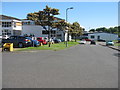
The lifestyle in G68 0BL is shaped by its proximity to essential retail and transport hubs. Within walking distance are Aldi Westway Rp and multiple Spar stores, providing straightforward access to groceries, household items, and daily necessities. These shops cater to a practical, no-frills approach to shopping, ideal for residents prioritising convenience over expansive retail choices. The rail network adds flexibility, with stations at Cumbernauld, Greenfaulds, and Croy offering links to nearby towns and cities. This connectivity supports both commuting and socialising, allowing residents to travel for work, leisure, or services without relying heavily on cars. While there are no parks or leisure facilities explicitly listed in the data, the absence of protected natural areas or planning constraints suggests a focus on built environments rather than green spaces. The area’s character is defined by its accessibility and simplicity—suitable for those who value straightforward living without the complexities of larger urban or rural settings.
Amenities
Schools
| Rank | School | Type | Entry gender | Ages |
|---|
Explore more schools in this area
Go to Schools tabDemographics
Household Size
Accommodation Type
Tenure
Ethnic Group
Religion
Household Composition
Age
Household Deprivation
NS-SEC
Explore more demographic insights in this area
Go to Demographics tabPlanning
Planning Constraints
- Flood RiskPremium
- Ramsar Wetland SitesPremium
- Area of Outstanding Natural BeautyPremium
- Protected Nature ReservePremium
- Protected WoodlandPremium
- Crime RiskPremium