Area Overview for G66 8HS
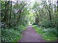
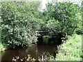
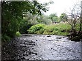
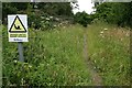
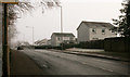
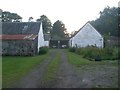
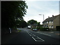
Photos of G66 8HS


Area Information
G66 8HS is a small residential cluster in Scotland, covering 5,737 square metres. It offers a compact, focused living environment with easy access to nearby rail networks and retail options. The area’s proximity to Lenzie, Bishopbriggs, and Stepps railway stations means commuters can reach major cities like Glasgow swiftly. For daily essentials, residents have access to five retail outlets, including Co-op Milton and Lidl Harestanes, ensuring convenience for shopping and dining. The digital infrastructure is robust, with a broadband score of 100—indicating excellent connectivity—making it ideal for remote work or online activities. While the area is small, its strategic location and practical amenities create a functional, low-maintenance lifestyle. It appeals to those seeking a quiet, accessible suburb without the sprawl of larger towns. The absence of significant natural constraints, such as protected woodlands or AONB designations, means development is unlikely to restrict future growth or property value. For buyers, G66 8HS represents a blend of practicality and connectivity, tailored for those prioritising ease of movement and modern infrastructure.
- Area Type
- Postcode
- Area Size
- 5737 m²
- Population
- Not available
- Population Density
- Not available
The property market in G66 8HS reflects a small, tightly knit residential area with a focus on owner-occupied homes. While specific ownership percentages are not provided, the presence of multiple retail and rail amenities suggests a stable, localised housing stock. The area’s compact size means property choices are limited to immediate surroundings, with no indication of large-scale rental developments. This suggests a community-oriented market where homes are likely to be occupied by long-term residents. The absence of planning constraints, such as protected nature reserves or AONB areas, may contribute to a more straightforward buying process. However, the small footprint of the area means buyers should consider proximity to nearby towns for broader housing options. For those seeking a quiet, low-traffic environment with reliable transport links, G66 8HS offers a niche but practical alternative to more sprawling suburbs.
House Prices in G66 8HS
Showing 10 properties
| Address | Type | Beds | Baths | Last Sale Price | Last Sale Date | |
|---|---|---|---|---|---|---|
| 4 Linden Lea, Milton Of Campsie, G66 8HS | Detached | - | - | - | - | |
| 1 Linden Lea, Milton Of Campsie, G66 8HS | house | - | - | - | - | |
| 7 Linden Lea, Milton Of Campsie, G66 8HS | Detached | - | - | - | - | |
| 6 Linden Lea, Milton Of Campsie, G66 8HS | Detached | - | - | - | - | |
| 9 Linden Lea, Milton Of Campsie, G66 8HS | Detached | - | - | - | - | |
| 8 Linden Lea, Milton Of Campsie, G66 8HS | house | - | - | - | - | |
| 2 Linden Lea, Milton Of Campsie, G66 8HS | Detached | - | - | - | - | |
| 3 Linden Lea, Milton Of Campsie, G66 8HS | Detached | - | - | - | - | |
| 5 Linden Lea, Milton Of Campsie, G66 8HS | Detached | - | - | - | - | |
| 10 Linden Lea, Milton Of Campsie, G66 8HS | house | - | - | - | - |
Energy Efficiency in G66 8HS
Residents of G66 8HS benefit from a selection of nearby retail and dining options, including Co-op Milton, Co-op Antermony, and Lidl Harestanes. These stores provide essentials, groceries, and convenience services, supporting a self-sufficient lifestyle within walking or short driving distance. While the area lacks large parks or leisure facilities, the proximity to rail stations opens access to broader regional amenities. The small, clustered nature of the postcode fosters a close-knit community, with local shops and transport links creating a practical, low-maintenance daily routine. For those who prefer minimal travel, the area’s compact size ensures most needs are met locally. However, larger recreational opportunities would require venturing to nearby towns. Overall, G66 8HS offers a functional, community-focused lifestyle with a balance of convenience and accessibility.
Amenities
Schools
| Rank | School | Type | Entry gender | Ages |
|---|
Explore more schools in this area
Go to Schools tabDemographics
Household Size
Accommodation Type
Tenure
Ethnic Group
Religion
Household Composition
Age
Household Deprivation
NS-SEC
Explore more demographic insights in this area
Go to Demographics tabPlanning
Planning Constraints
- Flood RiskPremium
- Ramsar Wetland SitesPremium
- Area of Outstanding Natural BeautyPremium
- Protected Nature ReservePremium
- Protected WoodlandPremium
- Crime RiskPremium