Area Overview for G66 3JP
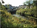
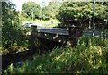
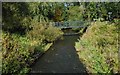
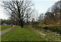
Photos of G66 3JP
Area Information
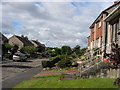
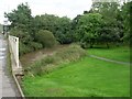
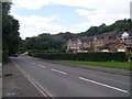
G66 3JP is a small, tightly knit residential postcode area in Scotland, characterised by its compact layout and proximity to essential services. This area is ideal for those seeking a quiet, community-focused lifestyle with easy access to local amenities. The postcode covers a modest cluster of homes, likely serving a mix of long-term residents and families. Its strategic location near rail networks and retail hubs makes it convenient for daily commutes and errands. While the area is small, it offers a balance of practicality and accessibility, with nearby railway stations providing links to larger towns and cities. The high broadband score of 91 and mobile coverage of 83 ensure reliable connectivity, supporting both work and leisure activities. For buyers, G66 3JP represents a blend of simplicity and modern convenience, with no significant environmental constraints or safety risks to hinder its appeal.
- Area Type
- Postcode
- Area Size
- Not available
- Population
- Not available
- Population Density
- Not available
House Prices in G66 3JP
No properties found in this postcode.
Energy Efficiency in G66 3JP
Daily life in G66 3JP is shaped by its accessible amenities, which include a range of retail options and transport hubs. Within walking distance are Spar stores, including Spar Newdyke and Co-op Merkland, offering convenience for grocery shopping and daily essentials. These shops cater to both routine needs and occasional purchases, reducing the need for long trips. The area’s rail stations—Lenzie, Stepps, and Robroyston—provide links to nearby towns, enabling easy access to larger retail centres, cultural venues, and employment hubs. While the postcode is small, the combination of local shops and rail connectivity fosters a practical, community-oriented lifestyle. Residents can enjoy a mix of self-sufficiency and broader opportunities, making G66 3JP suitable for those who value both convenience and accessibility in their daily routines.
Amenities
Schools
| Rank | School | Type | Entry gender | Ages |
|---|
Explore more schools in this area
Go to Schools tabDemographics
Household Size
Accommodation Type
Tenure
Ethnic Group
Religion
Household Composition
Age
Household Deprivation
NS-SEC
Explore more demographic insights in this area
Go to Demographics tabPlanning
Planning Constraints
- Flood RiskPremium
- Ramsar Wetland SitesPremium
- Area of Outstanding Natural BeautyPremium
- Protected Nature ReservePremium
- Protected WoodlandPremium
- Crime RiskPremium