Area Overview for G60 5AF
Photos of G60 5AF
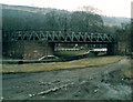
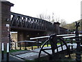
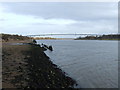
100 photos from this area
Area Information
Key information about the G60 5AF including its size, population, and administrative classification.
- Area Type
- Postcode
- Area Size
- 31.6 hectares
- Population
- Not available
- Population Density
- Not available
House Prices in G60 5AF
14
Properties
-
Average Sold Price
-
Lowest Price
-
Highest Price
Showing 14 properties
| Address | Type | Beds | Baths | Last Sale Price | Last Sale Date | |
|---|---|---|---|---|---|---|
| Helenslea, Woodlands Track, Bowling, G60 5AF | Semi-detached | - | - | - | - | |
| Lock Keepers Houses, Woodlands Track, Bowling, G60 5AF | undefined | - | - | - | - | |
| Railway Arches 2-5, Bowling Harbour Basin, Dumbarton Road, Bowling, G60 5AF | shop | - | - | - | - | |
| Airde, Dumbarton Road, Bowling, G60 5AF | Houseboat | - | - | - | - | |
| Upper Flat, Helenslea, Woodlands Track, Bowling, G60 5AF | Flat | - | - | - | - | |
| Lower Flat, Helenslea, Woodlands Track, Bowling, G60 5AF | Flat | - | - | - | - | |
| Dug Cafe, Railway Arch 3, Bowling Harbour Basin, Dumbarton Road, Bowling, G60 5AF | retail_financial | - | - | - | - | |
| Railway Arch 1, Bowling Harbour Basin, Dumbarton Road, Bowling, G60 5AF | retail_financial | - | - | - | - | |
| Glenarbuck Cottage, Dumbarton Road, Bowling, G60 5AF | Detached | - | - | - | - | |
| Railway Arch 5, Bowling Harbour Basin, Dumbarton Road, Bowling, G60 5AF | retail_financial | - | - | - | - |
Page 1 of 2
Energy Efficiency in G60 5AF
Amenities
Schools
| Rank | School | Type | Entry gender | Ages |
|---|
Explore more schools in this area
Go to Schools tabDemographics
Household Size
N/A
most common
Accommodation Type
N/A
most common
Tenure
N/A
majority
Ethnic Group
N/A
most common
Religion
N/A
most common
Household Composition
N/A
most common
Age
N/A
median
N/A
most common
Household Deprivation
N/A
with no deprivation
NS-SEC
N/A
in Lower managerial occupations
Explore more demographic insights in this area
Go to Demographics tabPlanning
Planning Constraints
- Flood RiskPremium
- Ramsar Wetland SitesPremium
- Area of Outstanding Natural BeautyPremium
- Protected Nature ReservePremium
- Protected WoodlandPremium
- Crime RiskPremium