Area Overview for Bearsden
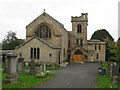
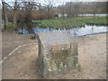
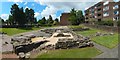
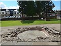
Photos of Bearsden


Area Information
Bearsden is a built-up area in Scotland covering 8.7 km². It functions as a distinct residential community rather than a sprawling city centre. Residents here likely enjoy a suburban lifestyle with access to local facilities within a short drive or walk. The area supports a variety of housing needs while maintaining a manageable size. You might find that daily errands require minimal travel time because key services are relatively close by. This district offers a defined sense of locality without the density found in larger urban zones. Homebuyers often seek stability and community cohesion in locations like you are considering. The layout suggests an environment where neighbours interact regularly and local streets form a coherent network. You will appreciate that Bearsden provides a concrete home base within the greater Glasgow context. The scale of 8.7 km² is sufficient for parks and green spaces without feeling empty. This area represents a practical choice for those prioritising a structured neighbourhood atmosphere. Whether you commute to nearby cities or stay local, the footprint of Bearsden supports a grounded routine. You get a specific type of settlement that balances residential privacy with accessible infrastructure.
- Area Type
- Built Up Area 250
- Area Size
- 8.7 km²
- Population
- Not available
- Population Density
- Not available
Living in Bearsden offers immediate access to practical amenities within practical reach of your home. Retail options include M&S Bearsden SF, Co-op Bearsden, and Spar, providing essentials for weekly shopping. You do not need to drive far to find grocery stores or clothing outlets. Transport links are well developed with Bearsden Railway Station, Hillfoot Railway Station, and Westerton Railway Station nearby. These stations connect you to wider networks without excessive journey times. For water travel, Yoker Ferry Terminal, Renfrew Ferry Terminal, and Braehead Shopping Centre Ferry Landing offer additional routes. If you prefer underground travel, Hillhead, Kelvinhall, and Kelvinbridge Underground Stations are available within the region. Glasgow International Airport stands as a nearby aviation hub for longer journeys. You can access KiwiRail ferries for coastal trips or train travel for cross-country business. The presence of Co-op and M&C Smiths in the retail category ensures daily needs are met locally. These named venues form a reliable infrastructure for your week. Residents benefit from a mix of rail and road connectivity supported by these specific terminals.
Amenities
Schools
| Rank | School | Type | Entry gender | Ages |
|---|
Explore more schools in this area
Go to Schools tabDemographics
The demographic profile of Bearsden relies on accurate Census figures which show independent living patterns. Available data indicates that 38% of households consist of individuals. This equips to roughly 760 single-person homes across the entire area based on current housing standards. You should note that many residents, specifically 48% of households, are couples without dependent children. This group often drives demand during the property market. The average household size stands at 2.2 people per home, reflecting a mature residential pattern. Children under 16 make up 16% of the total population, creating specific needs for schooling and leisure activities. Older adults represent 29% of residents, suggesting a significant cohort managing retirement planning or housing down-sizing. The area maintains a mixed tenure landscape where ownership and renting coexist. You will find that the population structure supports stable community engagement. These percentages allow you to calculate the demand for specific types of accommodation. The demographic distribution shows a balance between younger households and established families. Each percentage point reveals how daily life unfolds for different groups within this 8.7 km² zone.
Household Size
Accommodation Type
Tenure
Ethnic Group
Religion
Household Composition
Age
Household Deprivation
NS-SEC
Explore more demographic insights in this area
Go to Demographics tabPlanning
Planning Constraints
- Crime RiskPremium