Area Overview for Tullibody
Photos of Tullibody


Area Information
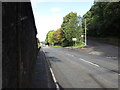
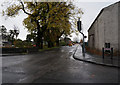
Tullibody is a built-up area situated in Scotland, covering a total land mass of 3.5 square kilometres. This compact footprint defines the residential character of the location, creating a close-knit environment where daily activities remain within easy reach. Residents enjoy a lifestyle centred on locality, with the town serving as a hub for those working, commuting, or focusing on local amenities. The geographical size suggests a manageable environment without the sprawl of larger urban centres. Living in Tullibody means navigating a community where the boundaries between home and neighbourhood are clear. The area supports a steady population that benefits from its central position within the broader regional transport network. While specific population figures are not detailed in the current overview, the infrastructure supports a functional town life. Housing options in Tullibody cater to various needs, providing a solid base for families or individuals seeking a Scottish townscape. The area stands as a distinct part of the local landscape, offering a balance of utility and community focus. Potential buyers recognise Tullibody not just as a postcode, but as a full address with established services. The town's identity is rooted in its practical nature, making it a considered choice for those who prioritise established settlements.
- Area Type
- Built Up Area 250
- Area Size
- 3.5 km²
- Population
- Not available
- Population Density
- Not available
Amenities
Schools
| Rank | School | Type | Entry gender | Ages |
|---|
Explore more schools in this area
Go to Schools tabDemographics
The demographic profile of Tullibody reflects a standard community structure typical of built-up areas in the region. Household composition varies, accommodating single occupants, couples, and families within the housing stock. Home ownership levels in Tullibody indicate a mix of owners and tenants, suggesting a balanced market for buyers considering purchase or rental. The age profile of residents supports a range of lifestyles, from young professionals to established families, ensuring schools near Tullibody serve a steady student body. Accommodation types in the area align with the needs of this demographic, offering flats and family homes suited to different life stages. There is no indication of significant deprivation affecting quality of life, allowing residents to focus on community engagement and local development. The diversity of the residents contributes to a stable social fabric within the 3.5 km² boundary. When assessing homes in Tullibody, the variety of tenures provides options for both first-time buyers and those seeking to join an existing community. The community feels established, with a population distributed across the available residential space.
Household Size
Accommodation Type
Tenure
Ethnic Group
Religion
Household Composition
Age
Household Deprivation
NS-SEC
Explore more demographic insights in this area
Go to Demographics tabPlanning
Planning Constraints
- Crime RiskPremium