Area Overview for Clackmannan
Photos of Clackmannan
Area Information
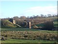
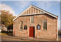
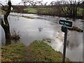
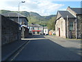
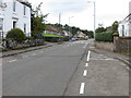
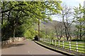
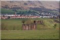
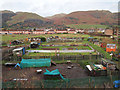
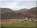
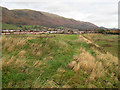
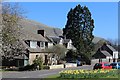
Clackmannan is located within Clackmannanshire, the smallest ceremonial county in the United Kingdom. This unitary council area covers 164.0 km² and sits within the Forth Valley. You will find the area positioned on the southwest edge of the landscape where the River Forth bounds the region. The River Devon separates the fertile carse from the moors of the Ochil Hills in the north. Local administration noted that the county town status moved to Alloa in 1822 due to that settlement's greater significance. Alloa remains the area's principal settlement, though Clackmannan town itself lies approximately 1.8 miles south-east of Alloa. The landscape includes significant village settlements at Alva, Tillicoultry, and Dollar along the foot of the Ochils. Historic landmarks like Clackmannan Tower, a 14th-century ruination built by the Bruce family, dominate the skyline above the town on King's Seat Hill. Residents experience a landscape defined by ancient Roman-era connections to the Damnonii tribe and later Pictish history. St. Serf visited the region in the late 7th century to convert the locals, leaving a well at Alva that commemorates this early Christian influence. You are looking at a region defined by its compact size and deep historical roots rather than rapid modern expansion. The coordinates 56.15°N, 3.74°W place you near the historic core of the town. Daily life here involves proximity to the River Devon and the rolling hills that characterize the historic county of Clackmannan.
- Area Type
- Ceremonial Counties Region
- Area Size
- 164.0 km²
- Population
- Not available
- Population Density
- Not available
Demographics
Your understanding of the community relies on specific demographic markers found within Clackmannanshire. The area functioned historically as the district of Mannan before becoming a unitary council area in 1996. Specific population figures remain unlisted in the provided records, yet the physical footprint of 164.0 km² suggests a low-density living environment. The settlement pattern includes the town of Clackmannan and surrounding villages like Alva and Dollar. These populated centres serve the broader county area which borders Stirling, Fife, and Perth and Kinross. Historical records indicate the name may derive from "Clachan-Mannan," suggesting ancient village roots. The community centres on Algoa, which acts as the principal settlement for the wider locale. There is no divided data on household types or age profiles in the available information. Consequently, you must view the community as a whole unit rather than segmented groups. The historic presence of the Bruce family and the Abbots of Cambuskenneth shaped the social fabric centuries ago. The 14th-century construction of Clackmannan Tower indicates a long-standing aristocratic influence on local life. While exact ownership levels are unspecified, the housing stock sits within a historic administrative boundary that reorganised in 1890 and later in 1975. You are living in an area where the transition from Royal Burgh status to a modern unitary council reflects broader Scottish governance changes. The diversity of the population is best understood through its physical dispersal across the Forth Valley landscape.
Household Size
Accommodation Type
Tenure
Ethnic Group
Religion
Household Composition
Age
Household Deprivation
NS-SEC
Explore more demographic insights in this area
Go to Demographics tabPlanning
Planning Constraints
- Crime RiskPremium