Area Overview for Fogo
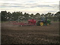
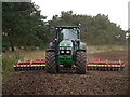
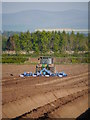
Photos of Fogo


Area Information
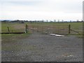
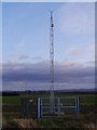
Fogo is a small built-up area in Scotland, covering 30.8 hectares. Its compact size suggests a focused, perhaps rural or semi-urban character, though specific details about its geography or surrounding landscape are not provided. The area is positioned within a broader Scottish context, potentially near larger towns or cities, though no adjacent locations are named in the data. Daily life in Fogo appears to revolve around proximity to essential services, with a Co-op store in nearby Duns offering retail access. While no population figures are available, the presence of a single retail outlet suggests a modest community scale. Residents likely value local convenience, with the area’s size implying a close-knit environment. The broadband score of 95 indicates excellent internet connectivity, which would support remote work and digital lifestyles. However, mobile coverage at 76 is described as good but not outstanding, which may affect reliance on mobile networks for communication. Fogo’s appeal seems tied to its practical amenities and digital infrastructure, though its distinctiveness remains largely unexplored by the data.
- Area Type
- Built Up Area 250
- Area Size
- 30.8 hectares
- Population
- Not available
- Population Density
- Not available
Living in Fogo provides access to a Co-op store in Duns, a nearby town, which serves as a key retail hub for daily essentials. This suggests that residents have practical access to shopping and services without needing to travel far. While no other amenities are listed in the data, the presence of a Co-op indicates a basic level of convenience for household needs. The area’s small size may foster a community-oriented lifestyle, though no specific parks, leisure facilities, or dining options are mentioned. Without further data on local attractions or recreational spaces, it is difficult to assess the full range of lifestyle options available. However, the proximity to Duns implies that additional amenities may be accessible within a short commute. The character of daily life in Fogo likely balances local simplicity with the practicality of nearby services, though the data does not provide a richer picture of its cultural or social offerings.
Amenities
Schools
| Rank | A + A* % | School | Type | Entry gender | Ages |
|---|
Explore more schools in this area
Go to Schools tabDemographics
Household Size
Accommodation Type
Tenure
Ethnic Group
Religion
Household Composition
Age
Household Deprivation
NS-SEC
Explore more demographic insights in this area
Go to Demographics tabPlanning
Planning Constraints
- Crime RiskLocked