Area Overview for Berwickshire
Photos of Berwickshire
Area Information
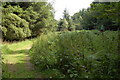
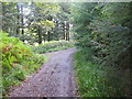
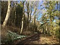
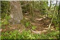
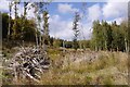
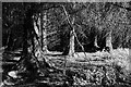
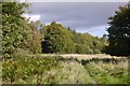
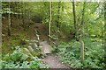
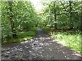
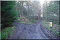
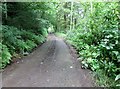
Living in Berwickshire means settling into a historic ceremonial county located in south-eastern Scotland. This region lies directly on the English border and stretches along the North Sea coast. The area encompasses a total land size of 918.8 square kilometres, offering a diverse landscape that includes the lowland Merse, the hilly Lammermuir range in the north, and the Lauderdale valley in the west. You will find that daily life here revolves around a distinct geographical split between agricultural lands supporting sheep farming and the uplands. The region takes its name from Berwick-upon-Tweed, although this original county town was ceded to England in 1482. Governance shifted subsequently, with Duns declared the official county town in 1903. Historical administration saw Berwickshire County Council operate from 1890 until 1975, after which the area merged into the Scottish Borders unitary council. Residents appreciate a setting that combines coastal access with rural tranquillity. The area now lies entirely within the Scottish Borders council area, removing the previous boundary ambiguity. Whether you prefer the flatlands for agriculture or the hills for visits, the geography defines the character of homes in Berwickshire. This mix of lowland and upland terrain creates a unique environment for those seeking a non-urban lifestyle within a defined historic county.
- Area Type
- Ceremonial Counties Region
- Area Size
- 918.8 km²
- Population
- Not available
- Population Density
- Not available
Demographics
The community profile for residents in Berwickshire is derived from specific housing and occupancy statistics. A precise breakdown of age distribution, household income, or ethnic diversity is not included in the current data set. Consequently, any description of the demographic makeup must rely on the available property ownership figures. You can verify that home ownership stands at 61.8% across the region. This figure indicates that nearly two-thirds of residents own their primary residence outright or via a mortgage. The remaining households reside in privately rented properties or livesituation categories not detailed in the provided metrics. The housing stock is not specified regarding terraced, semi-detached, or detached classifications in the source material. While specific figures for deprivation levels are absent, the high ownership rate suggests a stable tenure structure. Critics of the area might look for population density or school attendance rates, but these specific numbers are not available for analysis. The 61.8% ownership level provides a clear snapshot of the property dynamic. It suggests a market where securing a home brings long-term stability for the majority of locals. You should focus on the tenure data when assessing the community spirit and investment landscape. The lack of detailed demographic overlays means buyers should supplement this basic income or age data with local council reports if required for deep analysis.
Household Size
Accommodation Type
Tenure
Ethnic Group
Religion
Household Composition
Age
Household Deprivation
NS-SEC
Explore more demographic insights in this area
Go to Demographics tabPlanning
Planning Constraints
- Crime RiskPremium