Area Overview for Portgordon
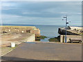
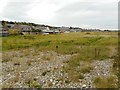
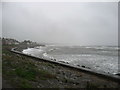
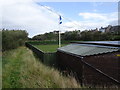
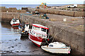
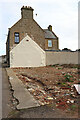
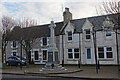
Photos of Portgordon


Area Information
Portgordon is a compact built-up area in Scotland, spanning 30.3 hectares. Its size suggests a close-knit community, with residents likely to know their neighbours and find convenience in nearby amenities. The area’s proximity to retail hubs like Spar Mckays, Morrisons Daily Buckie, and Tesco Buckie means daily errands are easily managed. For those working remotely, the broadband score of 100 ensures seamless connectivity, supporting home-based businesses or flexible work arrangements. Mobile coverage, rated at 79, is good enough for most needs, though not as robust as the broadband. The area’s character is defined by its practical scale and accessibility, making it suitable for those prioritising ease of living over sprawling urban sprawl. While specifics on population or demographics are not available, the presence of multiple retail outlets suggests a steady flow of residents and visitors. Portgordon’s appeal lies in its balance of functionality and community, with no major infrastructure gaps to hinder daily life.
- Area Type
- Built Up Area 250
- Area Size
- 30.3 hectares
- Population
- Not available
- Population Density
- Not available
Living in Portgordon offers access to a range of practical amenities within easy reach. The area’s retail landscape includes Spar Mckays, Morrisons Daily Buckie, and Tesco Buckie, providing essential shopping options for groceries and daily needs. These stores likely cater to both locals and nearby residents, ensuring a steady supply of goods. While specific details on dining or leisure options are not provided, the presence of multiple retail outlets suggests a vibrant local economy. The area’s compact size means residents can walk or cycle to nearby points of interest, enhancing convenience. For families, the proximity to shops and services may reduce the need for long commutes, though further data on parks or recreational spaces would be needed to fully assess the lifestyle opportunities available.
Amenities
Schools
| Rank | School | Type | Entry gender | Ages |
|---|
Explore more schools in this area
Go to Schools tabDemographics
Household Size
Accommodation Type
Tenure
Ethnic Group
Religion
Household Composition
Age
Household Deprivation
NS-SEC
Explore more demographic insights in this area
Go to Demographics tabPlanning
Planning Constraints
- Crime RiskPremium