Area Overview for Banffshire
Photos of Banffshire
Area Information
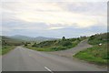
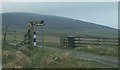
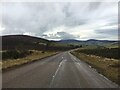
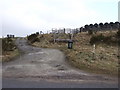
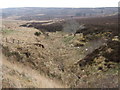
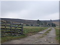
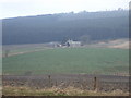
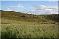
Living in Banffshire means residing in a historic ceremonial county in northeastern Scotland that stretches from the Cairngorm and Grampian Mountains to the North Sea coast. You will find the landscape divided between the rugged peaks of Ben Macdui and the rolling plains leading to the Moray Firth. The county town is Banff, but Buckie stands as the largest settlement to the west. Since 1996, the historic territory is split between the modern council areas of Aberdeenshire and Moray, meaning you may cross county lines while travelling only a few miles. The area measures 1646.3 km² and covers an elongated distance of approximately 50 miles from north to south. This narrow span, only eight miles wide near Keith, creates a tight-knit feel despite the vast geography. Your daily life blends the calm of coastal towns like Cullen and Macduff with the quiet industry of whisky-producing villages such as Glenlivet and Dufftown. Major landmarks including Duff House, Auchindown Castle, and the Coll Leonard Sculpture Park serve as cultural anchors for residents. You live in a region where prehistoric cairns at Longman Hill sit alongside famous distilleries like Aberlour and Glenfarcas.
- Area Type
- Ceremonial Counties Region
- Area Size
- 1646.3 km²
- Population
- Not available
- Population Density
- Not available
Demographics
You will find Banffshire is a historic county that celebrates its roots through places like the kirk of Gamrie and the ruins of medieval castles. The community is defined by its long history as a shire administered since the 12th century, with evidence of prehistoric habitation found near the coast. Settlements ranging from Aberchirder to Tomintoul form the residential backbone of the region. The population lives within a landscape that transitions from mountainous inland areas to glens and coastal plains. During the Reformation, the area witnessed significant conflict, such as the Battle of Glenlivet in 1594. Today, the community maintains a connection to these events as residents move through the countryside dotted with whisky distilleries and historic sites. The two Royal Burghs of Banff and Cullen historically served as commercial centres and now continue to anchor local life. You can access resources through the Historic County Trust and find records via ScotlandsPeople.gov.uk if you wish to trace local lineage. The local economy remains driven by whisky production, influencing the character of towns like Glenlivet and Aberlour.
Household Size
Accommodation Type
Tenure
Ethnic Group
Religion
Household Composition
Age
Household Deprivation
NS-SEC
Explore more demographic insights in this area
Go to Demographics tabPlanning
Planning Constraints
- Crime RiskPremium