Area Overview for Cults
Photos of Cults
Area Information
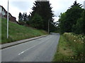
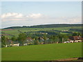
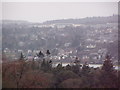
Living in Cults offers a distinct shift from typical urban living in Aberdeen. This built-up area, located on the western edge of Scotland's capital, functions as a suburban village despite being only six miles from the North Sea coast. Spanning 3.7 square kilometres, Cults retains the societal structures of a country settlement while maintaining close proximity to the city. The name derives from the Scottish Gaelic word for woods, hinting at its origins. Residents enjoy a setting characterised by historic granite housing and local community structures that define its identity. The area lies on the banks of the River Dee, which also marks the eastern boundary of Royal Deeside. CNCults functions as a residential district where the pace of life feels more akin to a village than a suburb. This balance allows families and individuals to access city amenities while enjoying local independence. The area developed significantly during the nineteenth century, with a railway station established on the Deeside line to connect it to Aberdeen. Today, this connectivity supports daily commutes, yet the neighbourhood preserves its unique heritage. Whether you are looking at homes in Cults or exploring what daily life entails, you find a community that blends village charm with urban access. The presence of green spaces and family-run shops further reinforces its character as a place where residents can maintain a traditional way of life.
- Area Type
- Built Up Area 250
- Area Size
- 3.7 km²
- Population
- Not available
- Population Density
- Not available
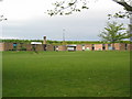
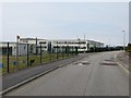
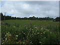
Daily life in Cults centres around a mix of local retail, scenic parks, and transport hubs that serve as gateways to wider opportunities. You will find five retail outlets in close proximity, including Tesco Aberdeen, Sainsburys Aberdeen North, and a Co-op Scotmid. These supermarkets provide all the essentials for weekly grocery shopping without requiring long drives. Cults East Church and Cults West Church history adds to the local identity, with the former building now serving as an outreach centre for the community. Allan Park stands as the largest green space in the district, located near the golf club and River Dee. This park is home to Cults Cricket Club and offers ample room for walks, gardening, and outdoor activities. The River Dee marks the eastern boundary of Royal Deeside, providing a natural boundary for your travels. Within practical reach, you also have access to Aberdeen Ferry Terminal and Aberdeen Airport, providing rapid connections to North Britain and international destinations. Dyce Railway Station lies nearby, offering another rail option for commuters. For aviation enthusiasts, Aberdeen Airport and Aberdeen Dyce Airport are both accessible from the area. The local retail scene includes a family-run toy shop, gift and furniture shops, and various hairdressers. These small businesses contribute to the village atmosphere, making Cults feel like a self-contained community. Whether you are shopping for groceries, taking your children to the park, or planning a trip abroad, the amenities are organised to serve resident needs efficiently.
Amenities
Schools
| Rank | School | Type | Entry gender | Ages |
|---|
Explore more schools in this area
Go to Schools tabDemographics
The community in Cults is defined by its specific residential patterns and historical development. While exact population figures are not provided in the current dataset, the area's character is shaped by its status as a developed residential zone. The housing stock reflects a period of significant growth, particularly after the Disruption of 1843, which led to the establishment of the Free Church of Scotland in the district. This history influences the local population, as many families have lived there for generations. The area maintains a population that values the historic granite architecture and established street patterns. Accommodation types within the 3.7 square kilometre boundary primarily consist of family homes built during the Victorian and early twentieth-century expansions. These properties were constructed to serve a growing population that required separation from the industrial heart of Aberdeen. The demographic profile suggests a settled community where residents have put down roots. Households are generally stable, supported by local amenities like parks and community centres. Although data on age distribution or specific deprivation indices is not available, the history of the area indicates a shift from agricultural to residential use by the late nineteenth century. This transition created an environment where new families could build homes near their workplaces. The result is a neighbourhood where daily life revolves around local institutions and family-oriented leisure spaces.
Household Size
Accommodation Type
Tenure
Ethnic Group
Religion
Household Composition
Age
Household Deprivation
NS-SEC
Explore more demographic insights in this area
Go to Demographics tabPlanning
Planning Constraints
- Crime & SafetyPremium