Area Overview for AB25 2QP
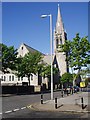
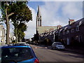
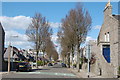
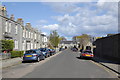
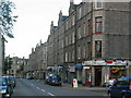
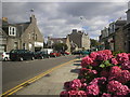
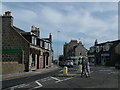
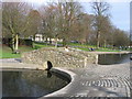
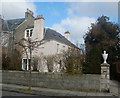
Photos of AB25 2QP

Area Information
AB25 2QP represents a specific residential cluster within the wider Aberdeen City council area, covering 3,699 square metres. This postcode sits in north-east Scotland, a region defined by granite architecture and its role as Europe's offshore oil capital. The immediate location is compact yet connected, situated astride the strategic coastal position that supports trade and education. Residents here benefit from proximity to major drains like the Rivers Dee and Don, which have historically shaped the city's layout. While the neighbourhood functions as a small residential pocket, it is surrounded by the broader infrastructure of Aberdeen, including universities and energy industries. Living in AB25 2QP means accessing the stable economy driven by the seaport and heliport while enjoying the managed pace of a specific postcode sector. The area combines urban characteristics with the practical realities of a defined postal zone in a historic royal burgh.
- Area Type
- Postcode
- Area Size
- 3699 m²
- Population
- Not available
- Population Density
- Not available
Housing stock in AB25 2QP encompasses a specific residential cluster in an urban setting. The area contains five retail outlets, two rail stations, one ferry terminal, and two airports within practical reach, influencing property values. While exact home ownership percentages are not listed for this specific postcode, the broader Aberdeen market reflects a mix of owner-occupied and rental homes. The presence of major transport hubs like Aberdeen Railway Station and Dyce Railway Station creates high demand for properties near access points. Homes in this area often reference the city's iconic granite buildings or serve as modern apartments near the North Sea coast. Property buyers here seek a foothold in an area dominated by the oil and gas industry since 1969. The limited area size of 3,699 square metres suggests a concentrated housing environment typical of established urban districts.
House Prices in AB25 2QP
Showing 30 properties
| Address | Type | Beds | Baths | Last Sale Price | Last Sale Date | |
|---|---|---|---|---|---|---|
| First Floor Left, 44 Thomson Street, Aberdeen, AB25 2QP | Flat | - | - | - | - | |
| First Floor Right, 44 Thomson Street, Aberdeen, AB25 2QP | Flat | - | - | - | - | |
| Ground Floor Right, 44 Thomson Street, Aberdeen, AB25 2QP | Maisonette | 2 | - | - | - | |
| First Floor Left, 38 Thomson Street, Aberdeen, AB25 2QP | Flat | - | - | - | - | |
| Ground Floor Right, 40 Thomson Street, Aberdeen, AB25 2QP | Flat | - | - | - | - | |
| Ground Floor Left, 42 Thomson Street, Aberdeen, AB25 2QP | Flat | - | - | - | - | |
| Ground Floor Right, 42 Thomson Street, Aberdeen, AB25 2QP | Flat | - | - | - | - | |
| Attic Floor Right, 40 Thomson Street, Aberdeen, AB25 2QP | Flat | - | - | - | - | |
| Ground Floor Right, 36 Thomson Street, Aberdeen, AB25 2QP | Maisonette | 2 | 1 | - | - | |
| First Floor Right, 42 Thomson Street, Aberdeen, AB25 2QP | Flat | - | - | - | - |
Energy Efficiency in AB25 2QP
Daily life in AB25 2QP offers convenient access to a range of services and leisure facilities. Within practical reach, residents find five retail outlets including Co-op Rosemount, Sainsburys Aberdeen, and Spar. Commuters rely on two nearby railway stations for travel to other cities, while the Aberdeen Ferry Terminal provides sea links to the north of Scotland via Northlink Ferries. Two airports in the vicinity, Aberdeen Dyce Airport and Aberdeen Airport, support both passenger travel and the busy aviation industry. The wider city landscape includes historic landmarks like St. Machar's Cathedral and King's College, enriching the cultural environment. The area's location near the Rivers Dee and Don provides a backdrop of historic waterways that have defined the settlement for over eight millennia.
Amenities
Schools
| Rank | School | Type | Entry gender | Ages |
|---|
Explore more schools in this area
Go to Schools tabDemographics
The provided data does not contain specific information regarding the age profile, household types, or diversity within this specific postcode. Consequently, the demographic picture relies on the known character of Aberdeen as a general urban city. The wider region hosts a university-town atmosphere supported by the University of Aberdeen and its colleges. This context suggests a population with links to higher education and the energy sector. Without specific figures on home ownership levels or accommodation types for AB25 2QP alone, potential homebuyers must consider the broader urban environment. The area's small size of roughly 3,700 square metres indicates a dense clustering rather than sprawling suburbs. While precise deprivation data is not available for this exact cluster, the city's transformation since 1969 has altered traditional sectors alongside educational growth.
Household Size
Accommodation Type
Tenure
Ethnic Group
Religion
Household Composition
Age
Household Deprivation
NS-SEC
Explore more demographic insights in this area
Go to Demographics tabPlanning
Planning Constraints
- Flood RiskPremium
- Ramsar Wetland SitesPremium
- Area of Outstanding Natural BeautyPremium
- Protected Nature ReservePremium
- Protected WoodlandPremium
- Crime & SafetyPremium