Area Overview for AB25 2GA
Photos of AB25 2GA
Area Information
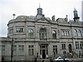
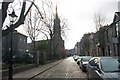
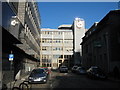
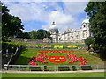
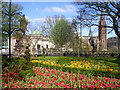
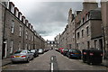
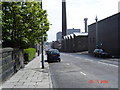
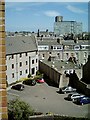
AB25 2GA is a specific residential postcode covering an area of 1782 square metres within the Aberdeen City council area. This location sits within a historic royal burgh defined by granite architecture and a strategic position astride the Rivers Dee and Don. The city originated as two separate settlements, Old Aberdeen on the River Don and New Aberdeen on the River Dee, before gaining official city status with expanded boundaries in 1891. Living in AB25 2GA places you within a community transformed since 1969 by the North Sea oil industry. Once reliant on traditional sectors like fishing and textiles, the region now functions as Europe's offshore oil capital while maintaining a university-town atmosphere. The area benefits from the presence of the University of Aberdeen and major landmarks such as King's College, founded in 1495, and St. Machar's Cathedral, begun in 1424. You will find yourself in an urban environment where the economy is driven by key assets including the largest seaport in north-east Scotland and a busy heliport. The character of the neighbourhood reflects this blend of historical depth and modern industrial strength, supported by a network of transport links connecting residents to Edinburgh and Glasgow.
- Area Type
- Postcode
- Area Size
- 1782 m²
- Population
- Not available
- Population Density
- Not available
Specific data regarding home ownership percentages and accommodation types for postcode AB25 2GA is not available in the current records. Therefore, a precise description of whether this specific cluster is primarily owner-occupied or a rental market cannot be provided. The available information confirms that AB25 2GA is a small residential area covering 1782 square metres, but it does not include breakdowns of house builds, tenancy rates, or price trends for this exact location. In the absence of these figures, buyers should note that detailed insights into the housing stock are unavailable for this specific cluster. While the wider Aberdeen City council area has a substantial population of 249,750, the granular data required to describe the property market within AB25 2GA is missing. You cannot currently determine if the area favours landlords or homeowners based on the provided statistics. The lack of data on accommodation types means you cannot identify whether terraced, semidetached, or apartment homes dominate this postcode range.
House Prices in AB25 2GA
Showing 12 properties
| Address | Type | Beds | Baths | Last Sale Price | Last Sale Date | |
|---|---|---|---|---|---|---|
| 11 Westburn Court, Aberdeen, AB25 2GA | Flat | - | - | - | - | |
| 10 Westburn Court, Aberdeen, AB25 2GA | Flat | - | - | - | - | |
| 4 Westburn Court, Aberdeen, AB25 2GA | Flat | - | - | - | - | |
| 7 Westburn Court, Aberdeen, AB25 2GA | Flat | - | - | - | - | |
| 5 Westburn Court, Aberdeen, AB25 2GA | Flat | - | - | - | - | |
| 2 Westburn Court, Aberdeen, AB25 2GA | Flat | - | - | - | - | |
| 3 Westburn Court, Aberdeen, AB25 2GA | Flat | - | - | - | - | |
| 8 Westburn Court, Aberdeen, AB25 2GA | Flat | - | - | - | - | |
| 1 Westburn Court, Aberdeen, AB25 2GA | Flat | - | - | - | - | |
| 12 Westburn Court, Aberdeen, AB25 2GA | Flat | - | - | - | - |
Energy Efficiency in AB25 2GA
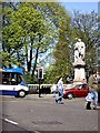
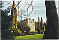
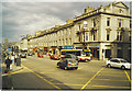
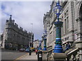
Residents of AB25 2GA enjoy immediate access to five retail venues, including Sainsburys Aberdeen, Iceland Aberdeen FWH, and Co-op Rosemount. These supermarkets support weekly shopping needs within practical reach. Transport links bring you closer to two railway stations, Aberdeen Railway Station and Dyce Railway Station, alongside the Aberdeen Ferry Terminal for maritime travel. Two airports, Aberdeen Dyce Airport and Aberdeen Airport, are also nearby, offering flexibility for domestic and international flights. The area sits within Aberdeen, a city noted for its granite architecture and university heritage. Historical landmarks such as the Brig o' Balgownie, a Scheduled Ancient Monument built in 1320, and the Old Bridge of Dee from 1527 define the local landscape. The Castlegate commercial area provides further shopping options. Cultural life centres around King's College, founded in 1495, and Marischal College, recognised as the world's largest granite building begun in 1844. St. Nicholas Kirk, dating back to pre-1157, stands as a testament to the region's deep history. This mix of retail convenience and historical significance shapes daily life for those living in AB25 2GA.
Amenities
Schools
| Rank | School | Type | Entry gender | Ages |
|---|
Explore more schools in this area
Go to Schools tabDemographics
Community statistics for AB25 2GA are not provided in the available records, so specific details regarding age profiles, household types, or diversity levels cannot be stated for this exact cluster. However, the broader context of Aberdeen informs the area's demographic environment. The city population stands at 249,750, forming a significant urban centre in north-east Scotland. While precise data for AB25 2GA is absent, the surrounding Aberdeen City council area contains a mix of residents influenced by the local education sector and energy industry. The demographic makeup of the wider city reflects a shift from its traditional industrial past to a modern economy centred on higher education and energy drilling. Without specific figures for this small postcode, one cannot determine exact ownership levels or accommodation types within these 1782 square metres. Prospective buyers must rely on neighbouring statistics to gauge the typical resident, though the area's small size means local demographics may vary significantly from city-wide averages. The lack of detailed breakdown means you cannot currently assess deprivation indices or tenancy rates specifically for this cluster.
Household Size
Accommodation Type
Tenure
Ethnic Group
Religion
Household Composition
Age
Household Deprivation
NS-SEC
Explore more demographic insights in this area
Go to Demographics tabPlanning
Planning Constraints
- Flood RiskPremium
- Ramsar Wetland SitesPremium
- Area of Outstanding Natural BeautyPremium
- Protected Nature ReservePremium
- Protected WoodlandPremium
- Crime & SafetyPremium